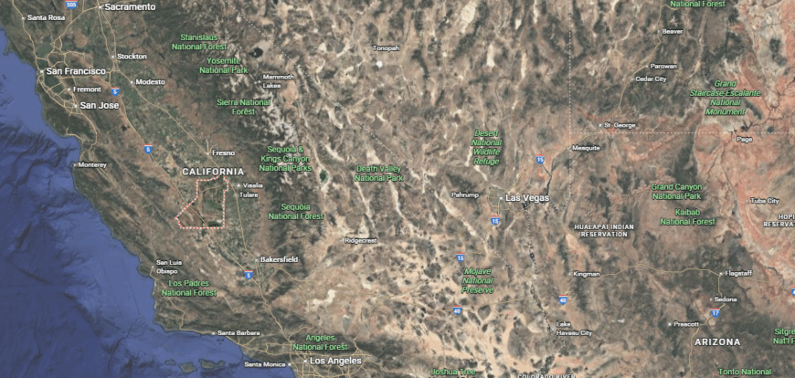
Counties with the shortest life expectancy in California
Life expectancy can be affected by a variety of factors. About 25% of your lifespan is determined by genetics, according to the National Library of Medicine. Health and wellness habits—like following a balanced, nutrient-rich diet; not smoking; drinking minimal alcohol; maintaining a healthy weight; and staying physically active—can add more than a decade to your life, research from the National Institutes of Health shows. While these factors are significant, another important element that you might not have considered is your environment and community.
While life expectancy generally increases annually in the United States—jumping from about 70.8 years old to 77.5 between 1970 and 2022, according to the Centers for Disease Control and Prevention—this particular metric can vary from state to state or even county to county. In some parts of the country, the average lifespan is getting shorter based on a variety of risk factors on top of health, including socioeconomic factors like poverty, unemployment, income, and education.
According to a 2020 study from researchers at Penn State, West Virginia, and Michigan State Universities, communities with a higher population density, more fast food restaurants, and a high number of extraction industry-based jobs tend to have shorter life expectancies.
To find out how life expectancy varies within California, Stacker used 2024 County Health Rankings & Roadmaps from the University of Wisconsin Population Health Institute to identify the counties with the shortest life expectancy. Life expectancy measures the average number of years from birth a person can expect to live and is calculated based on the number of deaths in a given time period and the average number of people at risk of dying during that period. Counties with unreliable or insufficient data were excluded from the analysis. Mortality data came from the National Vital Statistics System.
Read on to see if your county is on the list.
You may also like: Counties where homes are selling the fastest in California

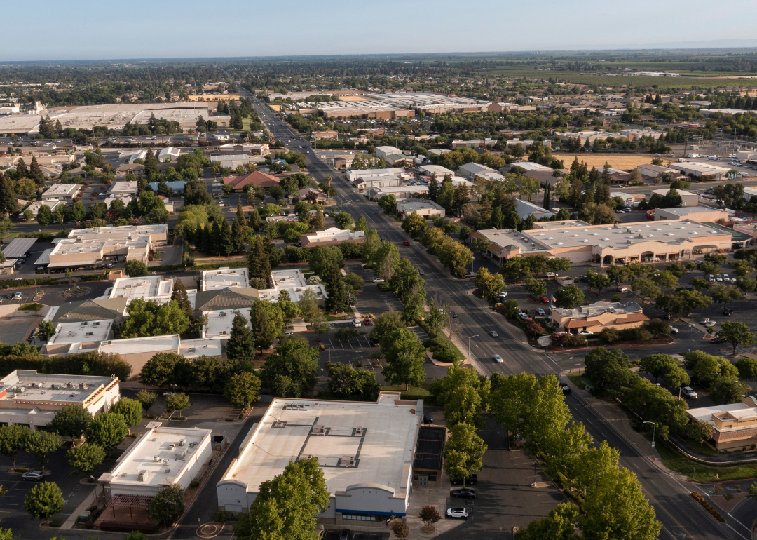
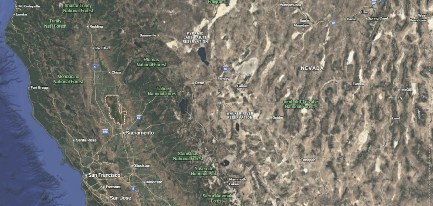
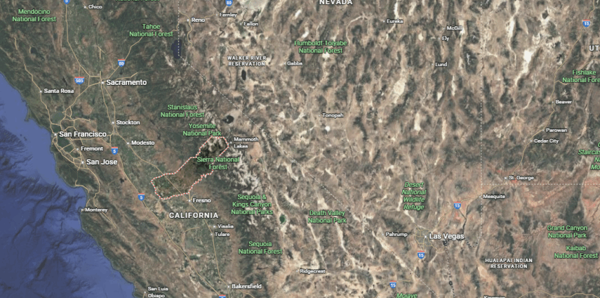
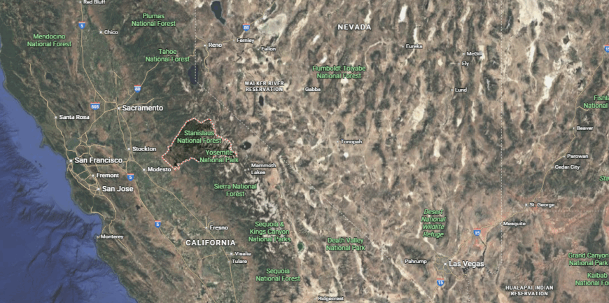
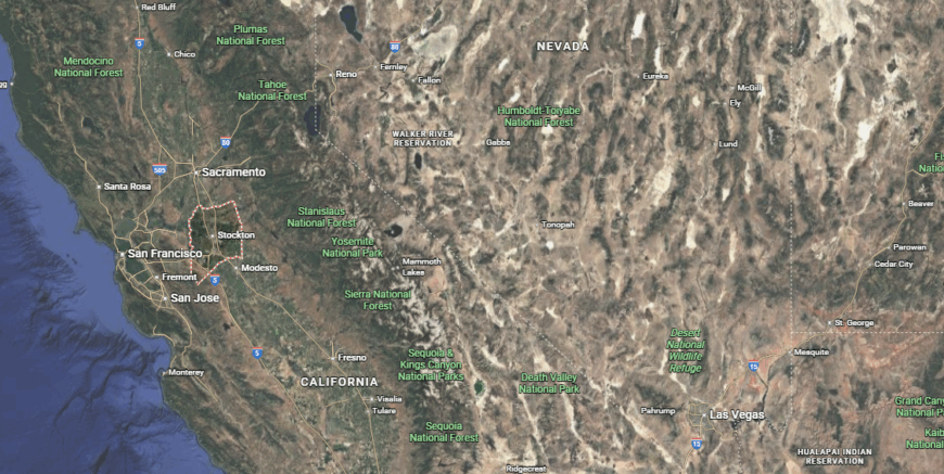
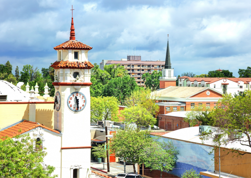
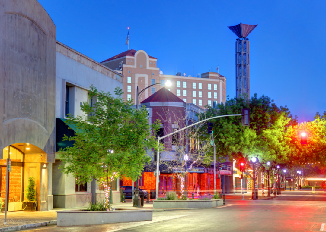
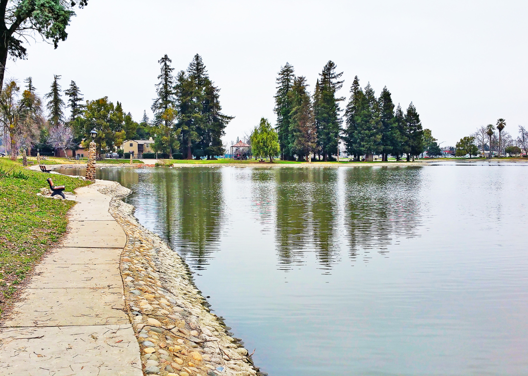
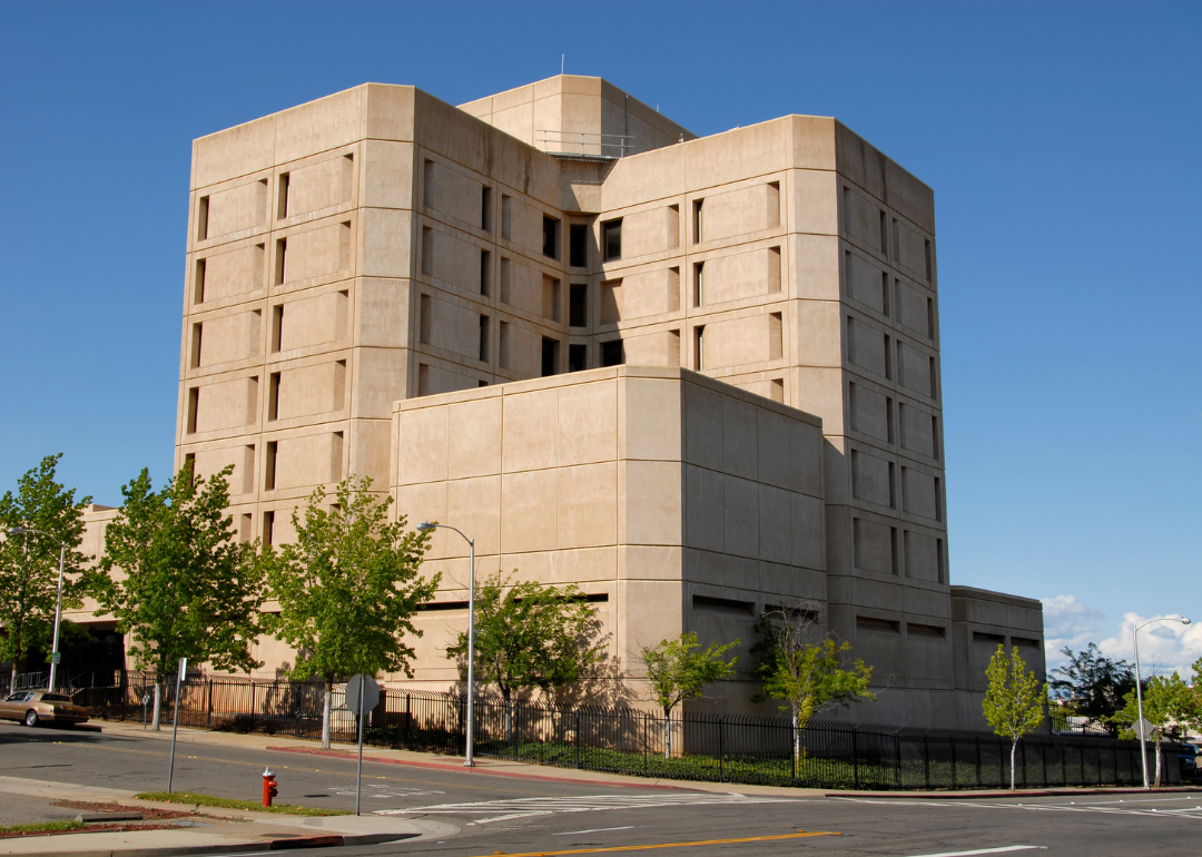
#28. Sacramento County
– Life expectancy: 78.4 years
— 1.5 years lower than the state average
About
Sacramento County blends California’s historic heart with a dynamic regional spirit rooted in government, agriculture, and riverfront life. Anchored by the state capital, it balances urban vitality with farmland, oak woodlands, and a strong connection to the American and Sacramento Rivers. Its setting at the confluence of waterways has shaped both its growth and enduring character.
Residents move between civic engagement, farmers’ markets, and outdoor recreation that has long defined the area’s identity. With deep ties to state history, diverse communities, and a landscape that bridges city and countryside, Sacramento County reflects a grounded yet evolving sense of place. Amid continuing expansion, it retains a strong emphasis on community connection and quality of life.
Where is Sacramento County?
Sacramento County lies in Northern California’s Central Valley, anchored by its county seat and largest city, Sacramento, which also serves as the state capital. Located at the junction of the Sacramento and American Rivers, the county stretches eastward toward the Sierra Nevada foothills and west across fertile valley farmland.
Surrounding communities such as Elk Grove, Folsom, and Rancho Cordova form a connected urban–suburban region. Known for its rich agricultural roots, extensive parkways, and role in government, the county offers access to outdoor recreation, historic riverfront districts, and regional transportation hubs.
#27. Plumas County (tie)
– Life expectancy: 77.5 years
— 2.4 years lower than the state average
About
Plumas County is defined by its rugged Sierra Nevada terrain, vast forests, and quiet mountain towns rooted in logging, rail, and mining history. Lakes, rivers, and alpine meadows create a landscape where outdoor life shapes both local identity and year-round rhythms. Its remote setting has long fostered independence, conservation values, and close ties to the land.
Residents embrace seasonal change through community fairs, trail-based recreation, and traditions centered on small-town connection. While tourism brings steady visitors, Plumas County maintains a strong sense of solitude, heritage, and self-reliance that continues to guide its way of life.
Where is Plumas County?
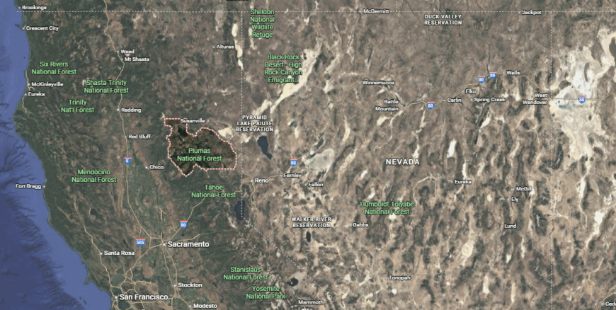
Plumas County is located in northeastern California within the northern Sierra Nevada, characterized by rugged mountains, dense forests, and over 100 lakes. Quincy, the county seat, sits roughly midway between Reno to the east and Chico to the west, serving as the area’s commercial and administrative center.
Nearby towns such as Portola, Greenville, and Chester are spread across scenic valleys connected by winding highways. Known for its outdoor recreation—including fishing, hiking, and boating—Plumas County is prized for its natural beauty, small-town atmosphere, and access to the Plumas National Forest.
#26. Sutter County (tie)
– Life expectancy: 77.5 years
— 2.4 years lower than the state average
About
Sutter County lies in the heart of the Sacramento Valley, shaped by rich agricultural lands, levee-lined rivers, and historic farming communities. Anchored by the Sutter Buttes — often called the world’s smallest mountain range — it reflects a landscape where crop cycles and waterways define both economy and identity. Its rural character has fostered a long-standing connection between residents and the land they cultivate.
Local life centers around harvest events, tight-knit towns, and traditions tied to generational farming. Though growth brings gradual change, Sutter County continues to embody a grounded, agrarian spirit rooted in resilience, stewardship, and community pride.
Where is Sutter County?
Sutter County lies in California’s Sacramento Valley, bordered by the Sutter Buttes—an isolated volcanic range rising from the valley floor. Yuba City, the county seat and largest community, sits along the Feather River opposite Marysville in neighboring Yuba County.
Smaller towns such as Live Oak and Sutter are surrounded by rich agricultural land producing rice, walnuts, and prunes. Known for its farming heritage, wildlife refuges, and proximity to the Sacramento River, Sutter County serves as a rural hub with access to regional transportation routes and outdoor recreation.
#25. Madera County (tie)
– Life expectancy: 77.4 years
— 2.5 years lower than the state average
About
Madera County stretches from fertile Central Valley farmlands to the granite peaks of the Sierra Nevada, encompassing a landscape tied to agriculture, ranching, and early logging routes into Yosemite. Its diverse terrain has shaped a working heritage where orchards, vineyards, and mountain trails coexist across distinct rural communities. The county’s history reflects steady development alongside a deep respect for land and resources.
Residents gather through fairs, rodeos, and local school traditions that reinforce multigenerational ties. Even as tourism and growth expand its foothold, Madera County maintains a rooted identity defined by hard work, natural beauty, and a steadfast sense of belonging.
Where is Madera County?
Madera County is located in California’s San Joaquin Valley, stretching from fertile valley farmland into the foothills and high country of the Sierra Nevada. The city of Madera serves as the county seat and main population center, positioned along Highway 99 between Fresno and Merced.
Smaller communities such as Chowchilla, Oakhurst, and Coarsegold connect valley agriculture with mountain recreation gateways. Known for its vineyards, orchards, and access to Yosemite National Park, Madera County blends agricultural heritage with tourism and outdoor adventure opportunities.
#24. Imperial County (tie)
– Life expectancy: 77.4 years
— 2.5 years lower than the state average
You may also like: How many people are receiving substance use treatment in California
About
Imperial County sits in California’s southeastern desert, formed by vast irrigated fields carved from the Colorado River and the stark landscapes of the Imperial and Mexicali Valleys. Built on agricultural innovation and cross-border ties, it produces year-round crops that are central to both local life and national food supply. Its harsh climate has shaped a unique resilience and deep reliance on water management.
Community life weaves together farming traditions, cultural festivals, and a strong binational exchange with neighboring Baja California. Though remote and extreme in environment, Imperial County embodies a proud identity grounded in perseverance, adaptability, and a thriving agricultural backbone.
Where is Imperial County?

Imperial County sits in southeastern California along the U.S.–Mexico border, occupying the southern end of the agriculturally rich Imperial Valley. El Centro, the county seat, lies roughly midway between the Salton Sea to the north and Mexicali, Mexico, to the south.
Surrounding communities such as Brawley, Calexico, and Imperial are tied to irrigation-based farming supported by the Colorado River. Known for its desert landscapes, geothermal activity, and winter agriculture, the county also provides access to recreational areas like the Glamis sand dunes and the Salton Sea shoreline.
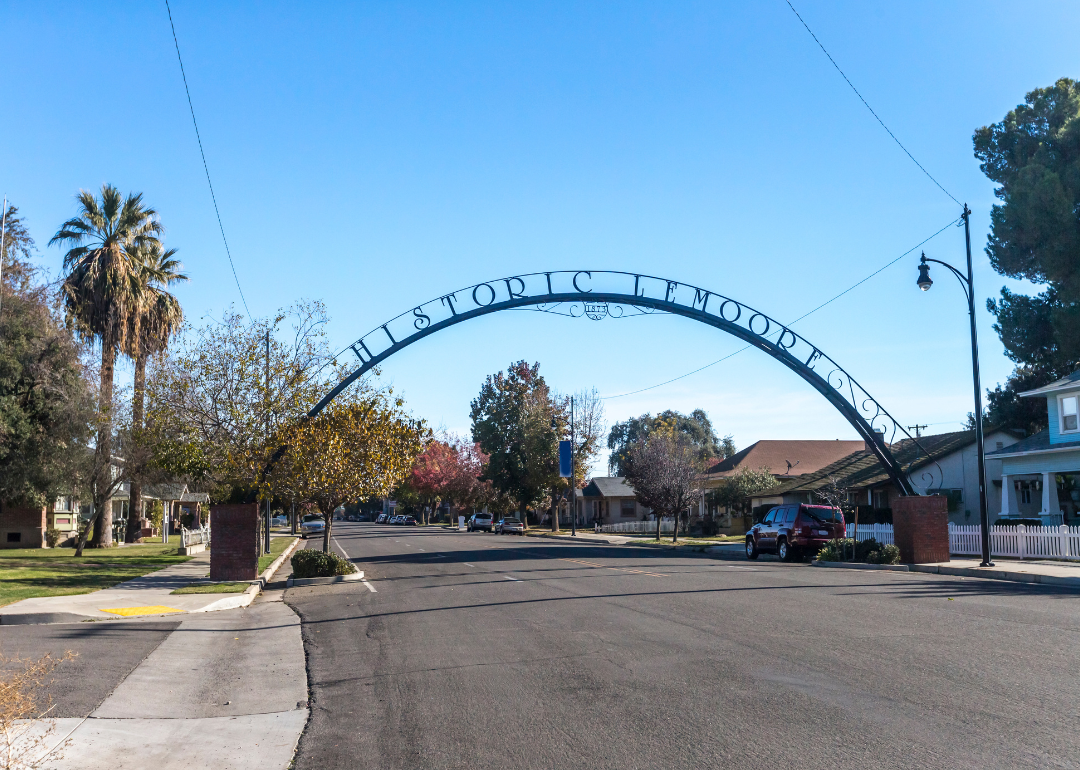
#23. Kings County
– Life expectancy: 77.3 years
— 2.6 years lower than the state average
About
Kings County lies in the southern San Joaquin Valley, defined by its rich agricultural fields, military ties, and historic towns shaped by rail and settlement patterns. With dairies, row crops, and orchards spanning fertile plains, the county’s identity is closely tied to productive farmland and hardworking rural communities. Naval Air Station Lemoore adds a distinct presence, blending agriculture with national defense.
Local life centers around harvest fairs, livestock shows, and family-rooted traditions that reinforce community bonds. While change steadily arrives through growth and modernization, Kings County continues to reflect a proud agricultural spirit built on service, heritage, and resilience.
Where is Kings County?
Kings County is located in California’s San Joaquin Valley, surrounded by fertile farmland that supports extensive dairy, cotton, and crop production. Hanford, the county seat and largest city, is positioned roughly midway between Fresno and Bakersfield and serves as the region’s cultural and commercial hub.
Nearby communities such as Lemoore, Corcoran, and Avenal are connected by rural highways and agricultural operations. Known for its farming and military presence—home to Naval Air Station Lemoore—Kings County blends small-town living with central access to major valley transportation routes.
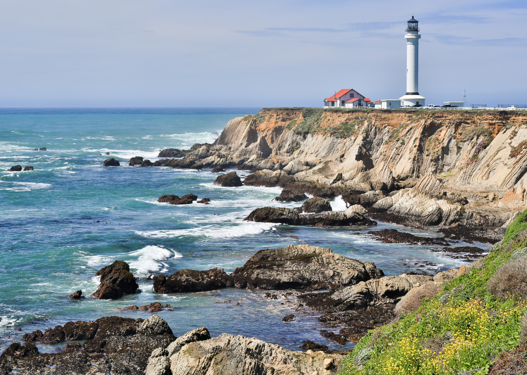
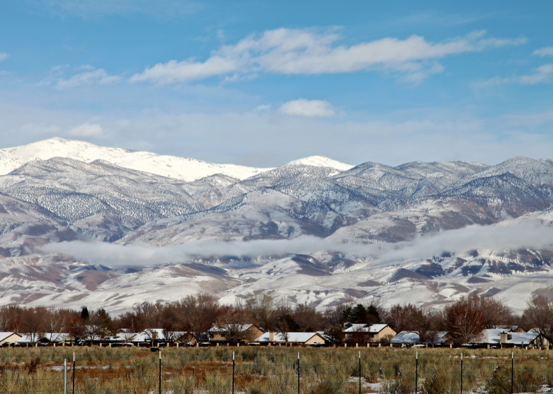
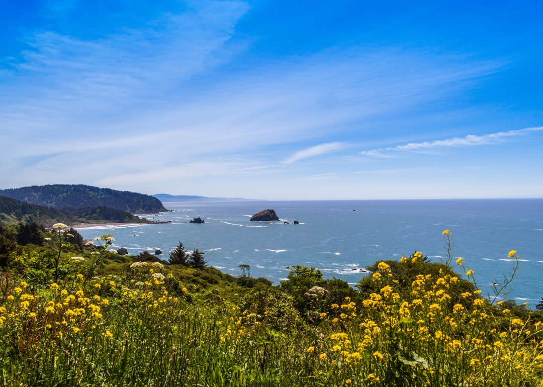
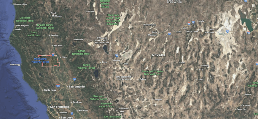
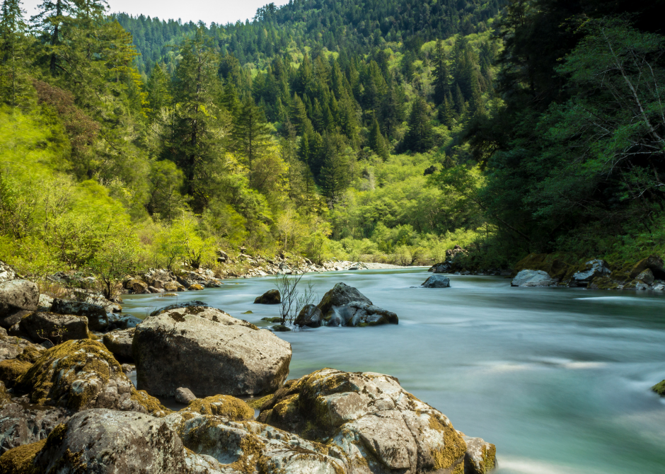
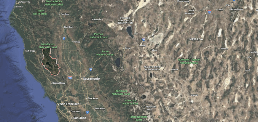
#22. Mendocino County
– Life expectancy: 77.2 years
— 2.7 years lower than the state average
About
Mendocino County stretches along Northern California’s rugged Pacific coastline and into redwood-filled interior hills, shaped by a history of logging, fishing, and early winemaking. Its dramatic landscape supports a culture rooted in small towns, coastal villages, and a tradition of independence shaped by both natural beauty and geographic isolation. The region’s identity blends artistic communities, agricultural heritage, and enduring environmental stewardship.
Residents take part in farmers’ markets, harbor festivals, and local fairs that highlight connection to sea, soil, and forest. Even as tourism and wine production grow, Mendocino County maintains a distinct character marked by creativity, self-reliance, and a deep reverence for its land and heritage.
Where is Mendocino County?
Mendocino County lies along California’s northern coast, spanning rugged shoreline, misty redwood forests, and inland valleys linked by Highway 101 and Highway 1. Ukiah serves as the inland county seat and commercial hub, while coastal towns such as Fort Bragg, Mendocino, and Gualala overlook dramatic Pacific cliffs.
Rural communities like Willits, Laytonville, and Anderson Valley anchor farming and viticulture areas. Known historically for timber and fishing, the county today blends small-town life, wine production, and outdoor recreation across a scenic, sparsely populated landscape.
#21. Inyo County (tie)
– Life expectancy: 77.0 years
— 2.9 years lower than the state average
About
Inyo County spans California’s high desert and towering Sierra Nevada peaks, home to both Death Valley’s depths and Mount Whitney’s summit. Shaped by mining history, ranching traditions, and stark extremes in elevation, its landscape fosters a rugged character defined by open space, solitude, and raw natural beauty. This dramatic terrain anchors a legacy of exploration, resourcefulness, and frontier spirit.
Residents connect through small-town events, outdoor pursuits, and long-standing ties to land and sky. Though tourism brings steady interest to its iconic landmarks, Inyo County retains a sparse, resilient identity rooted in endurance, independence, and a deep connection to its wild surroundings.
Where is Inyo County?

Inyo County stretches along California’s Eastern Sierra, covering vast desert basins and soaring peaks including Mt. Whitney—the highest point in the contiguous United States. Its county seat, Independence, sits along U.S. Route 395, a scenic corridor that connects remote communities such as Lone Pine, Bishop, and Big Pine.
Much of the landscape is publicly owned, encompassing Death Valley National Park, Owens Valley, and parts of the Inyo National Forest. Sparsely populated and geographically dramatic, the county is known for its extremes, outdoor recreation, and historic mining towns.
#20. Tuolumne County (tie)
– Life expectancy: 77.0 years
— 2.9 years lower than the state average
About
Tuolumne County lies in the foothills and high country of the central Sierra Nevada, shaped by Gold Rush boomtowns, lumber history, and gateway access to Yosemite National Park. Forested ridges, rivers, and old mining camps create a setting where heritage and outdoor life remain central to the region’s identity. Its landscape has long supported a blend of tourism, recreation, and small-town resilience.
Locals gather through county fairs, music festivals, and seasonal celebrations rooted in tradition and neighborly pride. Even with expanding visitation and growth, Tuolumne County holds firmly to its frontier roots, balancing preservation with a strong sense of place and community spirit.
Where is Tuolumne County?
Tucked into the western slopes of the central Sierra Nevada, Tuolumne County blends Gold Rush history with mountain wilderness. Sonora, the county seat, grew from a 19th-century mining camp into today’s small town center, surrounded by historic communities like Jamestown, Columbia, and Twain Harte.
The county stretches east into elevations that include Stanislaus National Forest and the northern entrance to Yosemite National Park, drawing visitors year-round for hiking, fishing, and snow play. A mix of foothill farms, forested ridges, and preserved heritage sites reflect its frontier roots while supporting a gateway tourism economy.
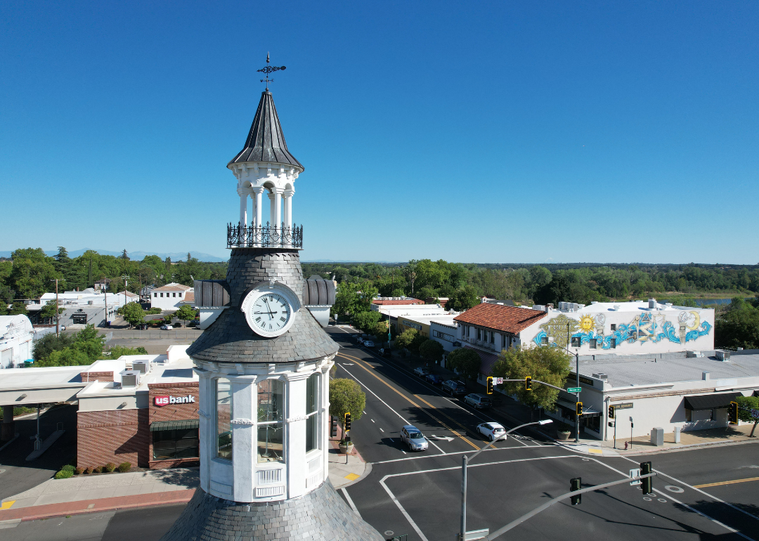
#19. Merced County
– Life expectancy: 76.9 years
— 3.0 years lower than the state average
You may also like: Best counties to live in California
About
Merced County sits in the heart of California’s San Joaquin Valley, defined by flat agricultural landscapes, canal-fed farmlands, and a long history of crop cultivation and dairy production. Rooted in rail-era development and sustained by water management, the county’s identity remains closely tied to farming, ranching, and growth along Highway 99. The presence of UC Merced introduces a rising focus on education and innovation alongside its rural backbone.
Community life revolves around fairs, rodeos, and school-centered traditions that reflect deep generational ties. While ongoing development slowly reshapes its cities and towns, Merced County continues to embody a strong agricultural heritage grounded in hard work, local pride, and steady resilience.
Where is Merced County?
Situated in the heart of California’s San Joaquin Valley, Merced County is defined by its rich agricultural plains and growing transportation links. The city of Merced serves as the county seat and central urban hub, home to the University of California, Merced, and positioned along Highway 99 and the BNSF rail line.
Surrounding towns such as Atwater, Los Banos, Livingston, and Gustine support farming operations that produce almonds, tomatoes, dairy, and sweet potatoes. With waterways like the Merced and San Joaquin Rivers threading through its flat landscape, the county balances its farming heritage with emerging education, logistics, and commuter connections.
#18. San Joaquin County (tie)
– Life expectancy: 76.6 years
— 3.3 years lower than the state average
About
San Joaquin County anchors the northern San Joaquin Valley, shaped by Delta waterways, fertile soils, and rail-to-port commerce that has long fueled its growth. Vineyards, orchards, and row crops stretch between rapidly expanding cities like Stockton, tracing a history rooted in agriculture and transportation. Its location at the heart of California’s inland Delta gives it a unique connection to both farm and freight.
Residents participate in county fairs, farmers’ markets, and riverfront traditions that celebrate heritage and community life. Even as suburban development continues to rise, San Joaquin County maintains a strong identity grounded in productive land, diverse cultures, and a deep relationship with its water-fed landscape.
Where is San Joaquin County?
Anchoring the northern end of California’s San Joaquin Valley, San Joaquin County serves as a vital crossroads of agriculture, transportation, and urban growth. Stockton, the county seat, lies at the head of the Sacramento–San Joaquin River Delta, linking valley farmland with the San Francisco Bay by an inland port.
Outlying cities such as Lodi, Tracy, Manteca, Lathrop, Ripon, and Escalon form a network of vineyard towns, commuter suburbs, and farming centers connected by Interstate 5 and Highway 99. Long known for crops like wine grapes, asparagus, and almonds, the county increasingly plays a role in regional logistics and serves as a key gateway between the Central Valley and Northern California’s coastal metro areas.
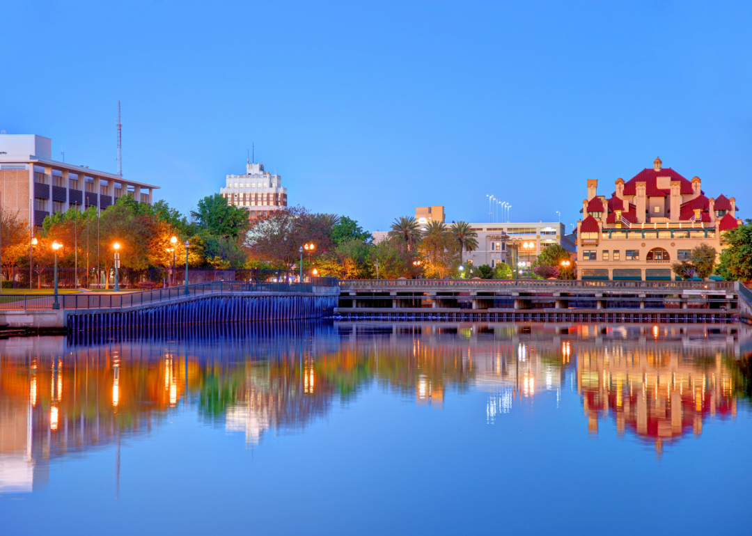
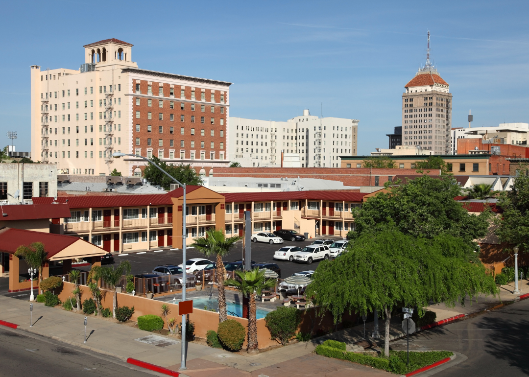
#17. Fresno County (tie)
– Life expectancy: 76.6 years
— 3.3 years lower than the state average
About
Fresno County lies at the center of California’s San Joaquin Valley, where fertile soils and expansive irrigation networks support one of the most productive agricultural regions in the nation. Orchards, vineyards, and vegetable fields stretch across the landscape, rooted in farming traditions that have shaped the area’s identity for generations. The City of Fresno serves as a growing urban hub, balancing civic life with its deep rural surroundings.
Locals come together through harvest celebrations, multicultural events, and strong ties to family-run farms and businesses. While growth, education, and new industries continue to evolve its future, Fresno County remains firmly grounded in its agricultural heritage, community spirit, and enduring connection to the land.
Where is Fresno County?
Covering a broad stretch of central California, Fresno County runs from fertile San Joaquin Valley farmlands eastward into the high Sierra Nevada, including parts of Kings Canyon and Sequoia National Parks. Fresno, the county seat and California’s fifth-largest city, anchors the valley’s agricultural economy and acts as a regional education, healthcare, and cultural hub.
Surrounding communities such as Clovis, Sanger, Reedley, Selma, and Kerman support farming operations that produce grapes, almonds, citrus, and dozens of other crops. With elevations ranging from flat valley orchards to snow-covered mountain passes, the county showcases a diverse landscape shaped by agriculture, water resources, and outdoor recreation.
#16. Butte County (tie)
– Life expectancy: 76.6 years
— 3.3 years lower than the state average
About
Butte County sits at the transition between the Sacramento Valley and Sierra Nevada foothills, shaped by orchards, rivers, and historic mining towns like Oroville and Chico. Its landscape blends fertile agricultural land with oak woodlands and canyon terrain, reflecting a heritage tied to farming, milling, and early gold discoveries. The county’s identity is marked by resilience, especially in the face of natural challenges like wildfire.
Residents gather at local festivals, university events, and community traditions rooted in long-standing civic pride. Even as growth and recovery bring new change, Butte County continues to embody a strong sense of place built on perseverance, agricultural roots, and a close relationship with land and community.
Where is Butte County?
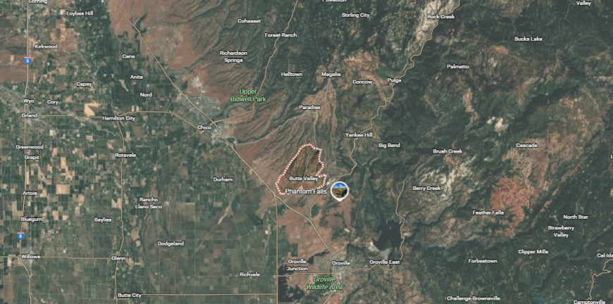
Butte County sits along the eastern edge of California’s Sacramento Valley, where orchards transition into the forested foothills of the northern Sierra Nevada. Chico, the largest city, is home to California State University, Chico and lies near Bidwell Park along Big Chico Creek, while Oroville serves as the county seat near the Feather River and Oroville Dam.
Smaller towns like Paradise, Gridley, and Durham are surrounded by walnut, almond, and rice farming operations. With landscapes shaped by rivers, reservoirs, and wildfire history, the county blends agriculture, education, and access to outdoor recreation across valleys, canyons, and upland terrain.
#15. Lassen County
– Life expectancy: 76.5 years
— 3.4 years lower than the state average
About
Lassen County stretches across northeastern California’s high desert and pine-covered mountains, shaped by ranching, logging, and its historic prison-railroad town of Susanville. Volcanic plateaus, vast rangelands, and distant peaks create a landscape where independence, open space, and frontier heritage remain central to daily life. Its geographic isolation has fostered a distinct identity grounded in self-reliance and natural beauty.
Local traditions include rodeos, county fairs, and outdoor pursuits that connect residents closely to land and wildlife. While the economy continues to evolve beyond its timber past, Lassen County maintains a proud, rural character rooted in perseverance, tradition, and wide-open horizons.
Where is Lassen County?

High in northeastern California, Lassen County spans sagebrush-covered plateaus, volcanic ridges, and expansive forests near the Nevada border. Susanville, the county seat, began as a logging town and now anchors a cluster of communities including Janesville, Herlong, Westwood, and Bieber spread along Highway 395 and rural byways.
Much of the landscape lies within publicly managed lands—Lassen National Forest, Modoc National Forest, and remote BLM tracts—which support ranching, recreation, and fire management. With proximity to Lassen Volcanic National Park and Eagle Lake, the county remains sparsely populated, rugged in character, and rooted in natural-resource traditions.
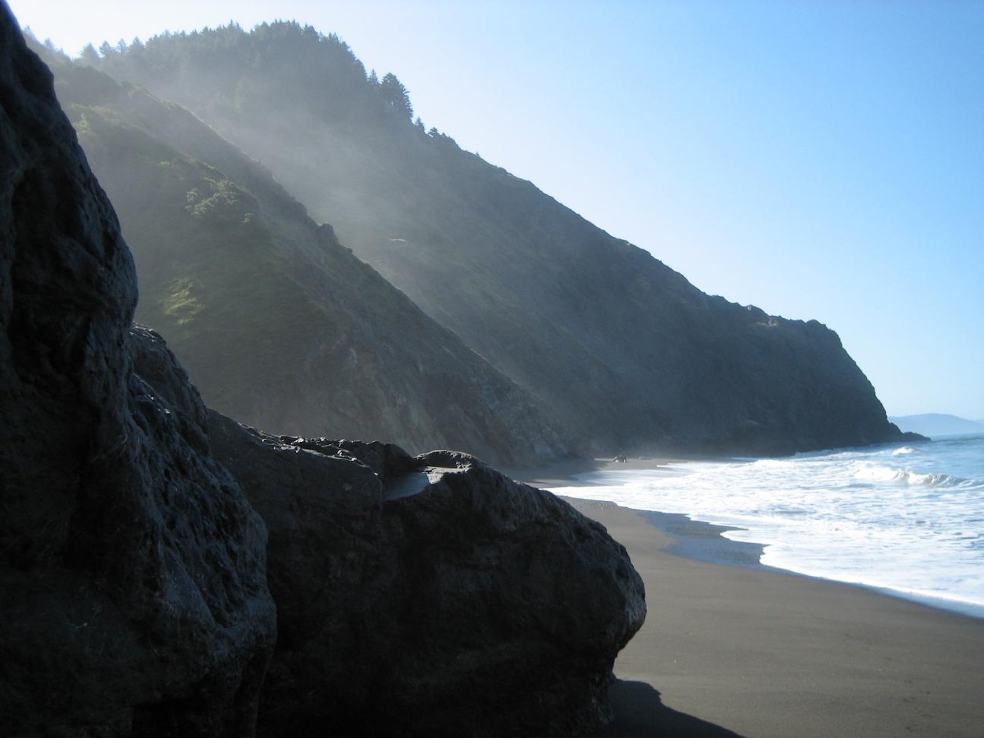
#14. Humboldt County
– Life expectancy: 76.4 years
— 3.5 years lower than the state average
You may also like: How opioid prescriptions to Medicaid patients in California stack up
About
Humboldt County hugs Northern California’s remote coastline, defined by fog-shrouded redwood forests, rugged cliffs, and a legacy of timber, fishing, and countercultural spirit. Historic Victorian towns like Eureka and Ferndale sit alongside wild rivers and preserves that reflect decades of environmental passion and resource-based industry. Its setting between forest and sea has long shaped an independent, nature-centered way of life.
Residents connect through local arts, festivals, and community markets that echo a commitment to creativity and stewardship. Even as tourism and new industries rise, Humboldt County retains a distinctive identity rooted in redwoods, resilience, and a strong sense of place at the edge of the Pacific.
Where is Humboldt County?
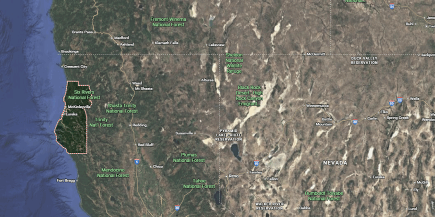
Humboldt County lies along California’s remote North Coast, where dramatic Pacific headlands meet towering redwood forests nourished by constant fog. The county seat, Eureka, and nearby Arcata are clustered around Humboldt Bay, serving as cultural, economic, and educational hubs for a scattered rural coastline.
Further north and south, towns like Fortuna, Trinidad, and Garberville thread along Highway 101 through river valleys and timber country. Long powered by logging and fishing, the region now leans on tourism and specialty agriculture while remaining defined by its wild landscapes, independent spirit, and deep-rooted connection to ancient forests and rugged ocean shores.
#13. Tulare County (tie)
– Life expectancy: 76.2 years
— 3.7 years lower than the state average
About
Tulare County lies in California’s southern San Joaquin Valley, where vast fields, orchards, and ranchlands sit beneath the snowcapped peaks of the Sierra Nevada. Long tied to dairy farming and crop production, the county’s identity blends agricultural strength with gateway access to Sequoia National Park and its towering giant trees. Historic towns and rural communities reflect a deep connection to land, water, and hardworking roots.
Residents gather through rodeos, harvest fairs, and school events that reinforce multigenerational ties and civic pride. While development spreads along Highway 99, Tulare County continues to embody a balance of natural grandeur and agrarian heritage shaped by resilience, tradition, and stewardship.
Where is Tulare County?
Tulare County stretches from rich San Joaquin Valley farmland to the rugged southern Sierra Nevada, rising sharply eastward into Sequoia and Kings Canyon National Parks. Visalia, the county seat, serves as a commercial and civic heart, while surrounding valley cities like Tulare, Porterville, and Dinuba support dairy, nut, and citrus operations fed by snowmelt from the Sierra.
The county’s eastern half is largely mountainous public land, crowned by giant sequoia groves and high granite peaks. Agriculture remains its economic backbone, yet outdoor recreation and tourism continue to grow as defining elements of this diverse, valley-to-summit landscape.
#12. Glenn County (tie)
– Life expectancy: 76.2 years
— 3.7 years lower than the state average
About
Glenn County rests in the northern Sacramento Valley, characterized by sprawling almond orchards, rice fields, and ranchlands nourished by the Sacramento River and extensive irrigation canals. Its history is rooted in farming, cattle operations, and small towns that grew along early rail and agricultural routes. The landscape reflects a steady rhythm of planting, harvest, and land stewardship that continues to shape local identity.
Community life centers around county fairs, 4-H programs, and traditions that highlight strong family and farming ties. Though modest in size and growth, Glenn County maintains a proud rural character grounded in resilience, cooperation, and a long-standing dedication to working the land.
Where is Glenn County?
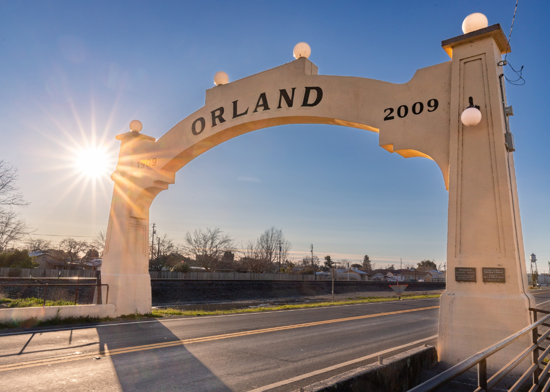
Glenn County occupies a rural stretch of California’s northern Sacramento Valley, bordered by the Sacramento River on the east and the Coast Range foothills to the west. Its county seat, Willows, and nearby community of Orland anchor small-town life amid orchards, rice fields, and cattle ranches connected by Interstate 5.
Much of the land is devoted to agriculture, producing almonds, walnuts, dairy, and grain while serving as winter habitat for migratory birds along the Pacific Flyway. With a landscape framed by fertile valley soils and rolling western hills, Glenn County remains quietly agricultural, sparsely populated, and deeply tied to its farming heritage.
#11. San Bernardino County
– Life expectancy: 76.1 years
— 3.8 years lower than the state average
About
San Bernardino County spans vast and varied terrain—from towering San Gabriel Mountains and pine-filled highlands to Mojave Desert basins and historic Route 66 towns. As the largest county in the contiguous United States by land area, it blends suburban growth, military presence, and rugged open spaces shaped by mining, rail, and migration history. Its diversity of landscapes supports an equally diverse population and economy.
Residents participate in mountain festivals, desert events, and civic traditions that reflect both frontier roots and modern expansion. Even as development continues across its many distinct regions, San Bernardino County retains a wide-open spirit defined by resilience, geographic contrasts, and a deep sense of opportunity.
Where is San Bernardino County?
San Bernardino County stretches across more than 20,000 square miles of Southern California, reaching from the Mojave Desert to the forested San Bernardino Mountains. The city of San Bernardino anchors the populous Inland Empire section, while desert towns like Victorville, Barstow, and Twentynine Palms extend north and east toward the Nevada and Arizona borders.
Known for its vast public lands and contrasting landscapes—from alpine lakes to arid basins—the county combines fast-growing suburbs with military, logistics, and recreation-based communities.
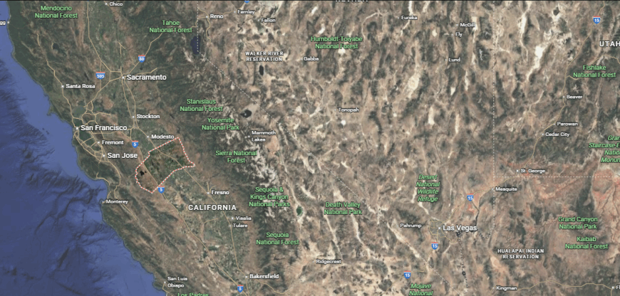
#10. Stanislaus County
– Life expectancy: 76.0 years
— 3.9 years lower than the state average
About
Stanislaus County sits in California’s Central Valley, its identity shaped by fertile farmland, rivers, and historic towns forged through rail and early settlement. Orchards, dairies, and row crops dominate the landscape, supporting a long-standing agricultural economy centered around hard work and seasonal rhythms. The city of Modesto anchors a growing urban core while remaining closely tied to its rural surroundings.
Residents come together for county fairs, farm-to-table events, and community traditions that emphasize local pride and multigenerational ties. As development and innovation gradually reshape the region, Stanislaus County continues to reflect a grounded, agrarian spirit built on resilience, family roots, and a strong connection to the land.
Where is Stanislaus County?
Located in the heart of California’s Central Valley, Stanislaus County is defined by flat farmland stretching along the Tuolumne and San Joaquin Rivers. Modesto, the county seat, serves as a regional hub for agriculture, food processing, and transportation along Highway 99.
Nearby cities such as Turlock, Ceres, Patterson, and Riverbank support orchards, dairies, and distribution centers tied to crops like almonds and tomatoes. Known for its strong farming base, the county also serves as a commuter corridor between the valley and the Bay Area.
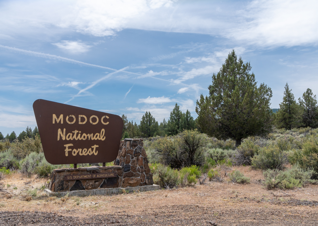
#9. Modoc County
– Life expectancy: 75.8 years
— 4.1 years lower than the state average
You may also like: The best beach towns in California
About
Modoc County occupies California’s remote northeastern corner, defined by volcanic plateaus, high desert valleys, and forested mountains shaped by ranching, logging, and early homesteading. Its sparse landscape fosters a strong sense of independence, self-reliance, and frontier heritage far removed from urban influence. Historic communities like Alturas reflect deep ties to land, wildlife, and enduring rural traditions.
Locals gather through livestock auctions, rodeos, and community events that emphasize close-knit connection and regional pride. Though modest in population and development, Modoc County maintains a resilient identity rooted in open space, perseverance, and a lasting bond with its rugged natural surroundings.
Where is Modoc County?
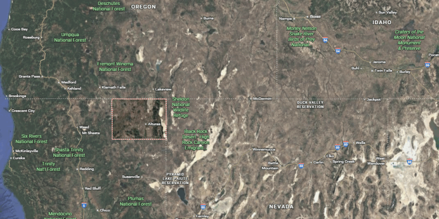
Modoc County occupies California’s remote northeast corner, where high desert plateaus meet volcanic mountains near the Oregon and Nevada borders. Alturas, the county seat, is surrounded by cattle ranches, juniper woodlands, and wildlife refuges in the expansive Modoc Plateau.
Scattered communities such as Cedarville, Adin, and Newell lie along rural highways and historic wagon routes. Sparsely populated and rugged, the county is rooted in ranching, timber, and outdoor recreation across a landscape of lava beds, lakes, and wide-open sky.
#8. Yuba County
– Life expectancy: 75.6 years
— 4.3 years lower than the state average
About
Yuba County rests in California’s northern Sacramento Valley and Sierra Nevada foothills, historically defined by Gold Rush settlements, levee-lined rivers, and fertile farmlands. The Yuba and Feather Rivers shape its landscape, supporting a legacy of agriculture, mining, and floodplain communities that have long adapted to changing conditions. Its blend of valley fields and foothill terrain fosters a varied rural character rooted in resilience.
Residents connect through county fairs, fishing derbies, and small-town traditions that reflect deep generational ties and local pride. While growth spreads along Highway 70 and 20, Yuba County continues to embody a grounded identity built on stewardship, history, and community loyalty.
Where is Yuba County?
Yuba County lies in California’s northern Sacramento Valley, where the Feather and Yuba Rivers flow south from the Sierra Nevada foothills toward fertile valley farmland. Marysville, the county seat, forms a historic commercial center across the river from Yuba City (in neighboring Sutter County), while nearby Linda, Olivehurst, Wheatland, and Browns Valley connect agricultural areas with residential growth.
Known for its orchards, levee systems, and access to the Yuba Goldfields, the county bridges rural valley agriculture with foothill recreation and historic mining landscapes.
#7. Tehama County
– Life expectancy: 75.0 years
— 4.9 years lower than the state average
About
Tehama County spans the northern Sacramento Valley and rolling Sierra Nevada foothills, rooted in a history of cattle ranching, farming, and early river trade along the Sacramento River. Its landscape features oak-studded grasslands, orchards, and historic towns like Red Bluff that reflect long-standing rural traditions and frontier heritage. The county’s identity blends agricultural strength with a deep connection to open space and natural resources.
Local life revolves around rodeos, county fairs, and seasonal events that highlight community pride and generational ties. Even as growth and new industries emerge, Tehama County continues to embody a grounded, self-reliant spirit shaped by hard work, land stewardship, and a close-knit way of life.
Where is Tehama County?
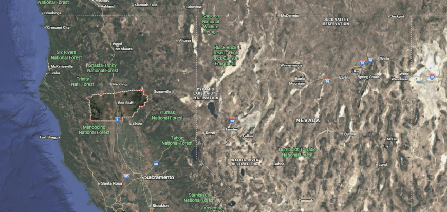
Tehama County sits in Northern California between the Sacramento Valley floor and the forested slopes of the Cascade and Coast ranges. Red Bluff, the county seat along Interstate 5, began as a riverport on the Sacramento River and remains its commercial hub.
South and west lie agricultural communities like Corning, Los Molinos, and Gerber surrounded by olive orchards, cattle ranches, and nut groves. To the east, the terrain rises into volcanic foothills and timberlands leading toward Lassen Peak, giving the county a mix of valley agriculture and rugged high-country landscapes.
#6. Shasta County (tie)
– Life expectancy: 74.9 years
— 5.0 years lower than the state average

About
Shasta County lies at the northern end of California’s Sacramento Valley, framed by volcanic peaks, sprawling forests, and the rivers and reservoirs that power its long hydroelectric legacy. Rooted in logging, mining, and railroad expansion, the region’s identity blends frontier history with a strong culture of outdoor recreation and natural resource management. Redding serves as the county’s urban heart, surrounded by mountains, lakes, and trails.
Residents gather through rodeos, festivals, and community events that celebrate both heritage and landscape. While tourism and development continue to grow, Shasta County maintains a rugged, independent character grounded in natural beauty, resilience, and a deep connection to its waterways and wild terrain.
Where is Shasta County?

Shasta County is located in far Northern California, where the northern Sacramento Valley meets the southern Cascade Range. Redding, the county seat, acts as the urban and commercial hub along Interstate 5, while nearby communities such as Anderson, Shasta Lake, and Burney connect rural valleys with forested uplands.
Anchored by landmarks like Shasta Lake, Lassen Peak, and the Sacramento River, the county is known for its hydropower reservoirs, outdoor recreation, and blend of valley living and mountain terrain.
#5. Kern County (tie)
– Life expectancy: 74.9 years
— 5.0 years lower than the state average
About
Kern County spans the southern end of California’s Central Valley into oil-rich foothills, wind-farm deserts, and the western slopes of the Sierra Nevada. Long defined by agriculture, petroleum, and aerospace, the county’s identity reflects a hardworking blend of industry, energy production, and rural traditions. Bakersfield anchors its civic and cultural life while remaining closely tied to its agricultural and blue-collar roots.
Residents participate in rodeos, Basque festivals, and county fairs that highlight diverse heritage and community pride. Even as expansion and innovation continue shaping new economic paths, Kern County retains a resilient spirit built on resourcefulness, tradition, and a deep connection to land and labor.
Where is Kern County?
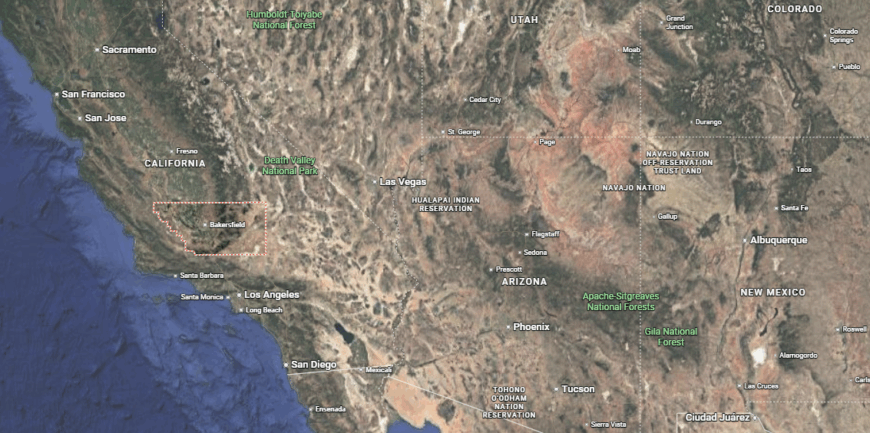
Kern County spans the southern end of California’s Central Valley, extending from oil fields and farmland around Bakersfield—its county seat—into the foothills of the Tehachapi and Sierra Nevada mountains.
Westward lie agricultural communities like Delano, Wasco, and Shafter, while to the east, desert towns such as Ridgecrest, Mojave, and Rosamond lead into the Mojave Desert. Known for its oil production, aerospace testing, and large-scale farming, the county bridges valley agriculture with energy, defense, and high-desert industry.
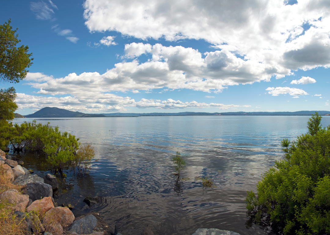
#4. Lake County (tie)
– Life expectancy: 74.6 years
— 5.3 years lower than the state average
You may also like: Best suburbs to live in California
About
Lake County centers around Clear Lake—the state’s largest natural freshwater lake—surrounded by volcanic hills, vineyards, and small towns rooted in ranching and early resort culture. Its identity blends agricultural heritage, winemaking, and outdoor living, shaped by a landscape that supports both fertile valleys and recreation-driven tourism. The region’s volcanic soils and natural beauty have fostered a strong sense of place and stewardship.
Local life revolves around fishing tournaments, harvest events, and community gatherings that reinforce deep ties and regional pride. While growth remains modest, Lake County continues to embody a laid-back rural character defined by resilience, community connection, and a lasting relationship with its land and waters.
Where is Lake County?
Lake County sits in northern California’s Coast Range, wrapped around Clear Lake—the state’s largest natural freshwater lake entirely within its borders. The county seat, Lakeport, and nearby towns such as Clearlake, Kelseyville, and Upper Lake cluster along the shoreline and in vineyard-filled valleys.
Known historically for pears and resorts, the county today blends wine production, outdoor recreation, and small-town living amid volcanic hills, oak woodlands, and a lake-centered landscape.
#3. Del Norte County (tie)
– Life expectancy: 74.6 years
— 5.3 years lower than the state average
About
Del Norte County sits on California’s far northwestern coast, where rugged shorelines, ancient redwood forests, and the Klamath River define a landscape of wild beauty and isolation. Rooted in fishing, logging, and Native American heritage, its identity reflects a strong connection to land and sea shaped by both natural bounty and geographic remoteness.
Residents engage in crab festivals, tribal gatherings, and outdoor traditions that highlight enduring cultural and environmental ties. Though sparsely populated and often weathered by storms, Del Norte County maintains a proud, frontier spirit grounded in survival, stewardship, and a deep reverence for its untamed surroundings.
Where is Del Norte County?
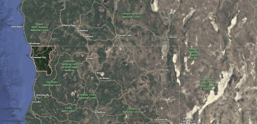
Del Norte County sits at California’s far northwestern tip, bordered by the Pacific Ocean and Oregon. Crescent City, the county seat, lies along a rugged coastline framed by steep bluffs and offshore rock formations, while inland communities like Smith River, Klamath, and Gasquet sit amid dense forest and wild rivers.
Dominated by redwoods, rocky beaches, and protected lands—including Redwood National and State Parks—the county remains sparsely populated, defined by its natural scenery, fishing heritage, and remote coastal setting.
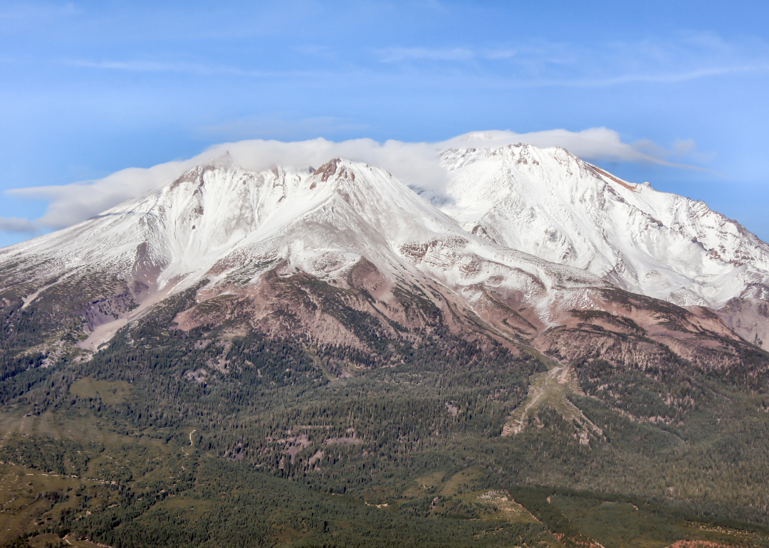
#2. Siskiyou County
– Life expectancy: 74.3 years
— 5.6 years lower than the state average
About
Siskiyou County stretches along California’s northern border, defined by volcanic peaks like Mount Shasta, forested wilderness, and river valleys shaped by logging, ranching, and Gold Rush history. Its remote landscape fosters a culture of independence, outdoorsmanship, and deep-rooted frontier heritage far from urban influence.
Community life revolves around county fairs, fishing derbies, and traditions that reflect multigenerational ties and rural pride. While tourism and lifestyle migration bring new faces, Siskiyou County continues to embody a rugged, self-reliant spirit rooted in nature, resilience, and a lasting connection to its wild northern terrain.
Where is Siskiyou County?
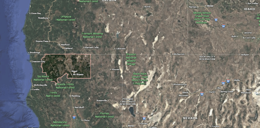
Siskiyou County stretches across California’s far northern border with Oregon, marked by dramatic landscapes that include alpine peaks, lava fields, and vast pine forests. Yreka serves as the county seat along Interstate 5, while nearby towns such as Mount Shasta, Weed, Dunsmuir, and Etna nestle at the base of snow-covered mountains and volcanic crags.
With much of its land in national forests and wilderness areas, the county’s identity is tied to outdoor pursuits, historic mining roots, and its proximity to iconic Mount Shasta.
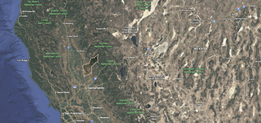
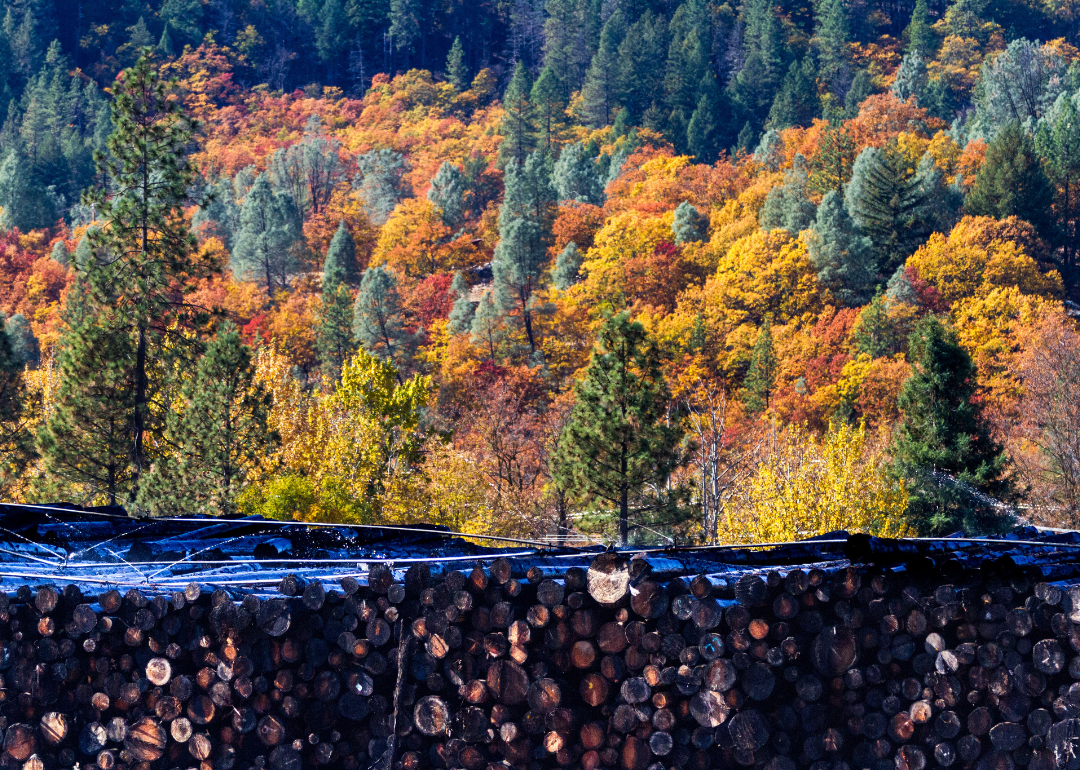
#1. Trinity County
– Life expectancy: 73.9 years
— 6.0 years lower than the state average
About
Trinity County lies deep within Northern California’s Klamath Mountains, its identity shaped by gold mining history, dense forests, and the winding Trinity River that threads through rugged terrain. Isolated towns, relics of the Gold Rush, and vast wilderness areas foster a lifestyle centered on self-sufficiency, outdoor recreation, and a strong connection to land and water.
Residents come together through festivals, fishing derbies, and small-town gatherings that reinforce close-knit bonds and regional pride. Though modern development remains minimal, Trinity County continues to reflect a frontier character defined by resilience, independence, and deep respect for its wild surroundings.
Where is Trinity County?
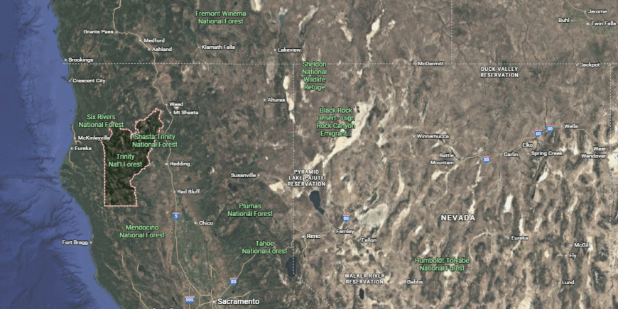
Trinity County lies in the forested mountains of northwestern California, carved by the winding Trinity River and surrounded almost entirely by national forest. Weaverville, the county seat, is a preserved 1850s Gold Rush town that now anchors a scattering of small communities like Hayfork, Junction City, and Trinity Center.
With no incorporated cities and rugged terrain, the county depends on forestry, tourism, and outdoor recreation. Known for its wild rivers, alpine lakes, and remote backcountry, Trinity remains one of California’s most sparsely populated and secluded counties.
Related: Discover the Top 23 California Counties Where Residents Live the Longest
This story features data reporting by Karim Noorani, writing by Kiersten Hickman, and is part of a series utilizing data automation across 49 states.
By Stacker