An analysis of America’s thirty most affordable neighborhoods, based on the most recent Zillow Home Value Index data from November 2024, reveals striking patterns in both geography and price trajectories. The most notable observation is the heavy concentration of these neighborhoods in Jackson, Mississippi, which accounts for eleven of the thirty areas, including all five of the lowest-priced neighborhoods. Flint, Michigan emerges as another significant cluster with six neighborhoods, all showing remarkable appreciation over the past decade, with Columbia Heights achieving an extraordinary 241.2% growth since 2014.
The data also shows that current values in these neighborhoods range from $21,692 to $32,732, with most areas showing substantial volatility in recent years. Despite being among the nation’s most affordable areas, many of these neighborhoods have demonstrated remarkable resilience, with twenty-two of the thirty showing positive growth over the past year. Perhaps most surprisingly, some of the strongest price appreciation occurred in neighborhoods that started from the lowest base values in 2014.
Wherever possible, I include an example of a home currently listed for sale priced around the 2024 home value.
Overview Chart
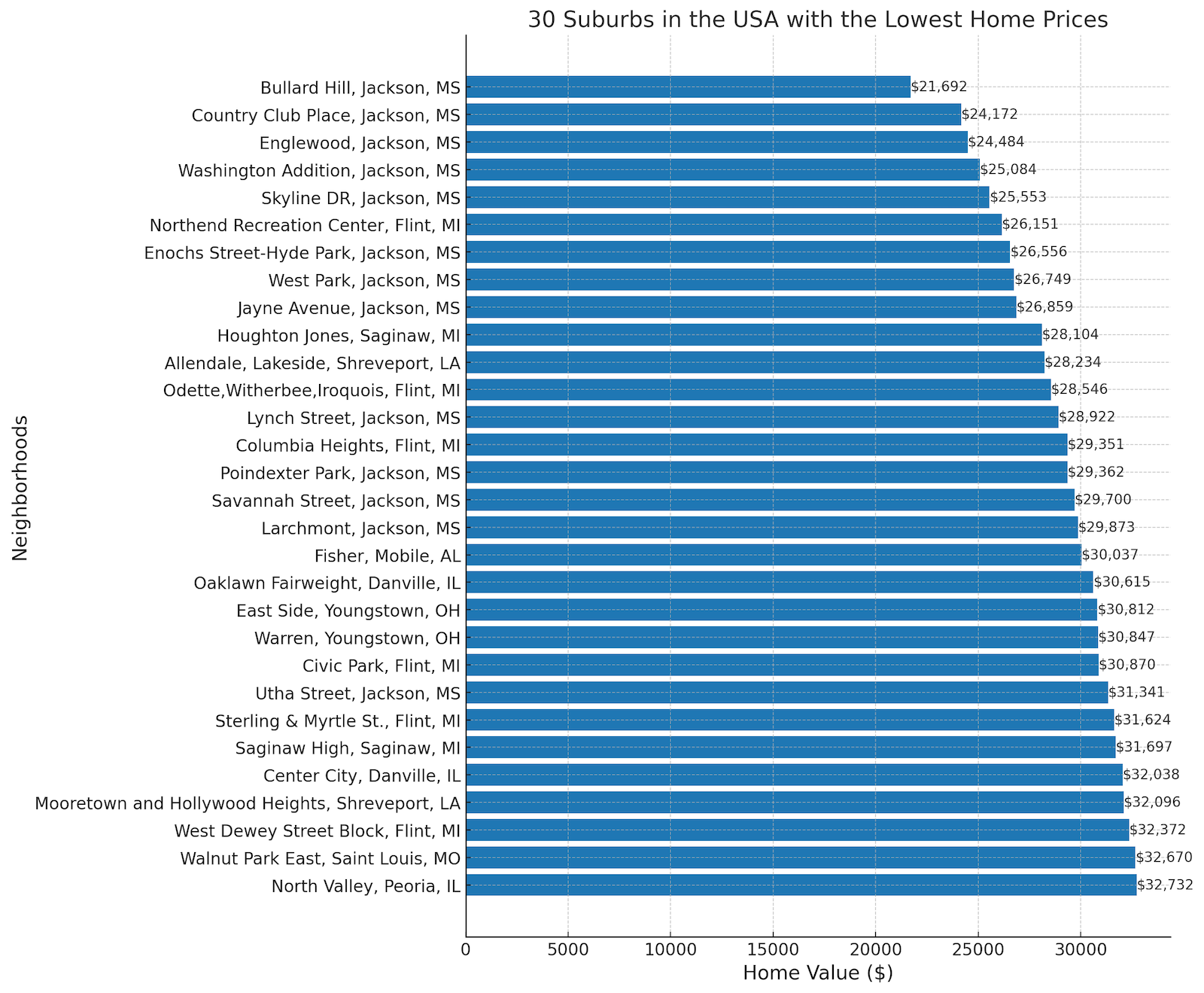
The geographic distribution of these neighborhoods presents a clear pattern of concentration in the American South and Midwest, with notable clusters in Michigan, Illinois, and Ohio beyond the dominant presence in Jackson, MS. These areas share common characteristics of being in cities that have faced significant economic challenges, often related to industrial decline or demographic shifts. Notably absent from the list are neighborhoods from coastal states or major metropolitan areas, suggesting that even the most affordable areas in those regions have substantially higher values. The data also reveals an interesting trend in recent market dynamics, with Jackson neighborhoods generally showing price declines over the past year while Flint neighborhoods consistently demonstrated appreciation, suggesting diverging economic conditions in these two major clusters.
30. North Valley, Peoria, IL
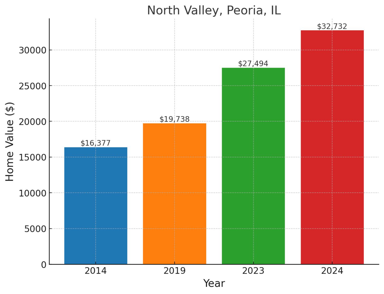
Tucked into the northern reaches of Peoria, North Valley stands as a testament to the city’s industrial heritage along the Illinois River. This riverfront district sits adjacent to the downtown area, offering residents easy access to the city’s cultural amenities and employment centers. Home values have shown remarkable strength, climbing from $16,377 in 2014 to $19,738 in 2019, then surging to $27,494 in 2023 before reaching $32,732 in November 2024. This upward trajectory represents a near-doubling of values over the decade with 99.9% growth since 2014, complemented by robust gains of 65.8% since 2019 and an impressive 19.1% jump in just the past year.
Example of a typical 2024 median-priced home in North Valley
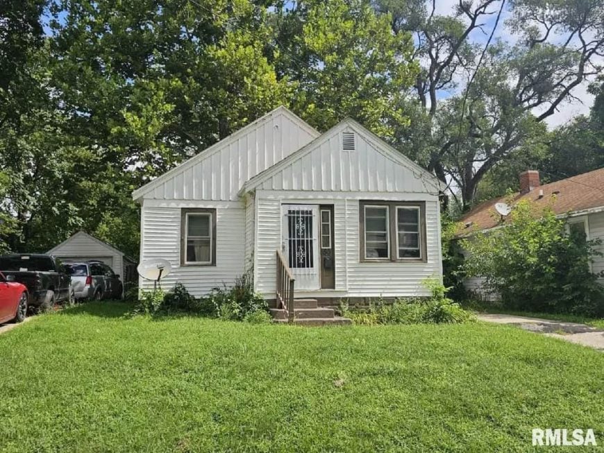
This home, priced at $34,500, features 2 bedrooms, 1 bathroom, and 720 square feet of living space. It includes recently painted cabinets and a newer water heater, offering convenient updates. The property is part of a 6-pack sale, which also includes homes at 1616 Peoria, 1618 Peoria, 401 E Republic, 1627 N New York, and 1307 Blaine.
Where is North Valley on the map?
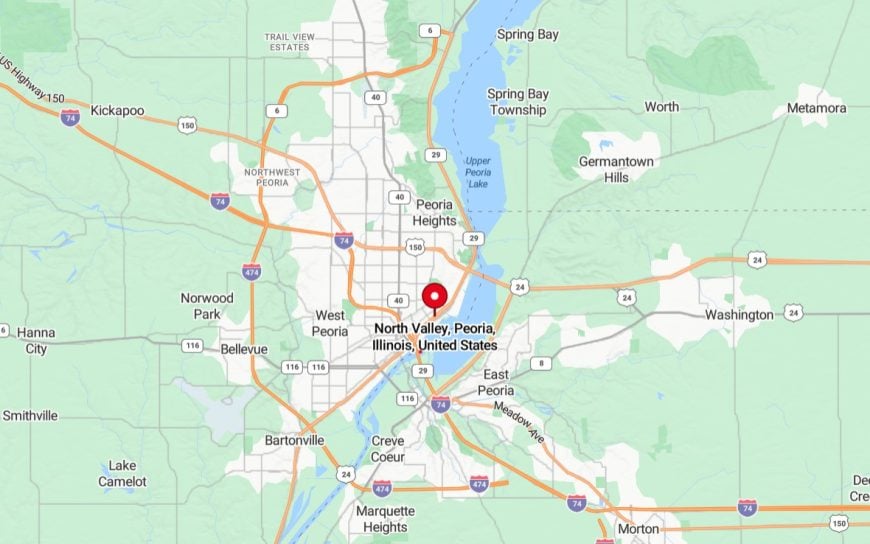
It’s a neighborhood located in Peoria, Illinois, situated just north of the downtown area. It is a primarily residential area with a mix of historic homes and modest housing, offering a sense of community for its residents. The neighborhood is conveniently close to local amenities, including parks, schools, and shops, while also providing easy access to major roads and public transportation. North Valley is known for its affordability and proximity to the city’s cultural and economic centers.
29. Walnut Park East, Saint Louis, MO
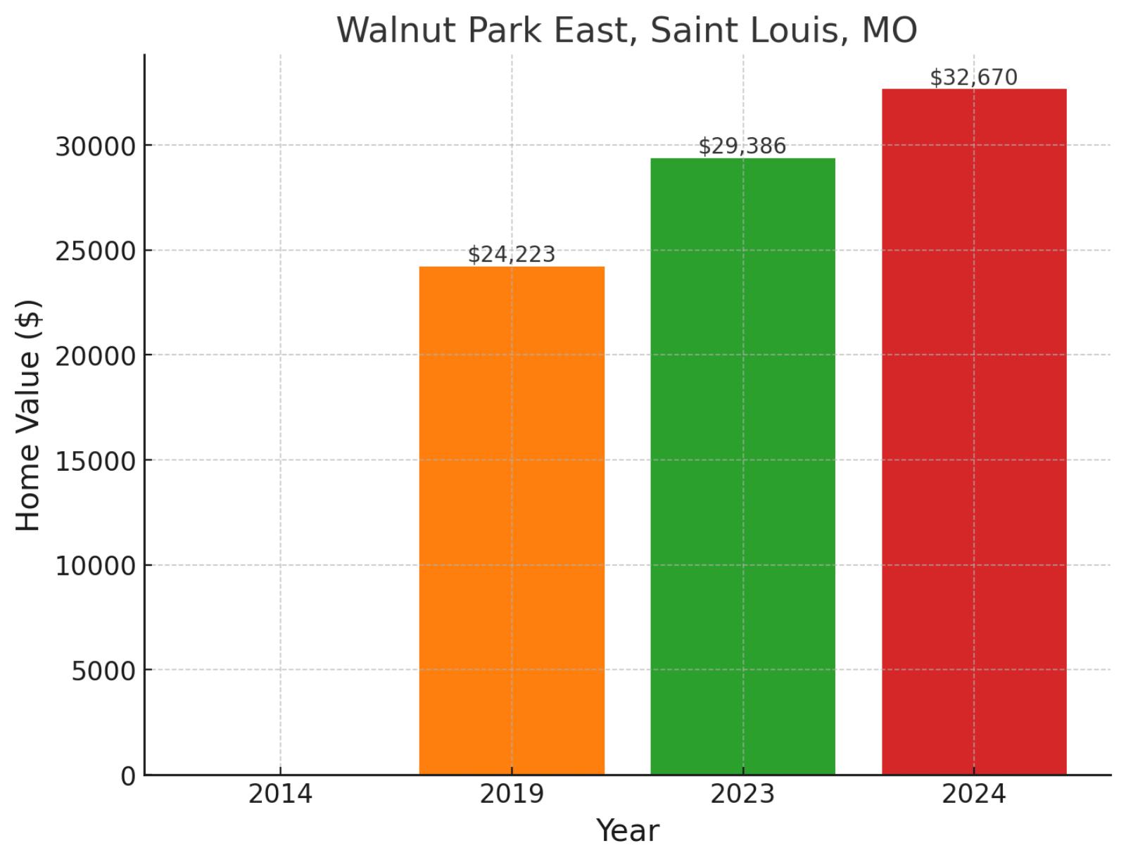
Positioned in the northern sector of St. Louis, Walnut Park East embodies the city’s ongoing transformation and community resilience. The neighborhood is strategically located near the confluence of Interstate 70 and Highway 367, providing vital transportation links to the broader metropolitan area. While 2014 data isn’t available, the area’s home values progressed from $24,223 in 2019 to $29,386 in 2023, before reaching $32,670 in November 2024, demonstrating healthy appreciation with 34.9% growth since 2019 and an encouraging 11.2% increase in the past year.
Example of a typical 2024 median-priced home in Walnut Park East
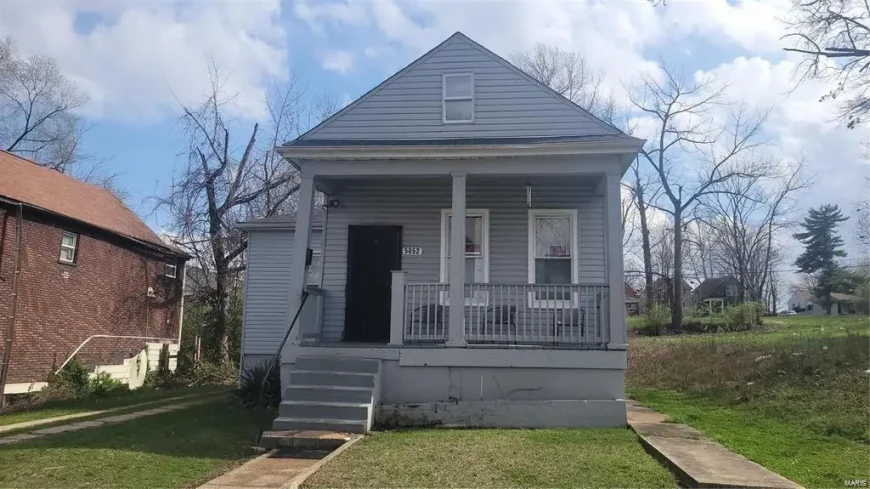
Priced at $34,900, this home offers 2 bedrooms, 1 bathroom, and 1,041 square feet of living space. It features a great lot on a quiet street, newer vinyl siding, a covered porch, and off-street parking. The property is being sold as-is, with no warranties, repairs, or inspections provided by the seller.
Where is Walnut Park East on the map?
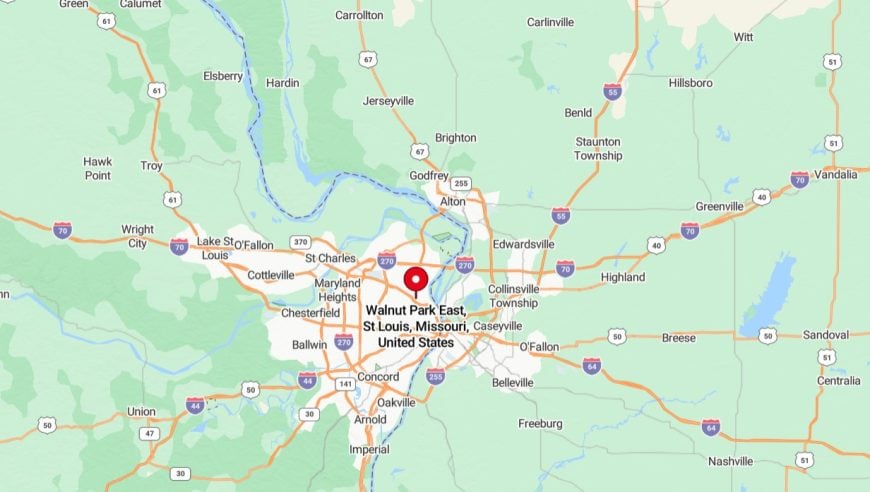
It’s a neighborhood located in the northern part of Saint Louis, Missouri. It is primarily residential, with a mix of single-family homes, small apartment buildings, and local businesses. The neighborhood is bordered by West Florissant Avenue and Riverview Boulevard, providing easy access to major roads and nearby amenities. Walnut Park East is part of a broader community-focused area in North St. Louis, with efforts underway to revitalize housing and infrastructure.
28. West Dewey Street Block, Flint, MI
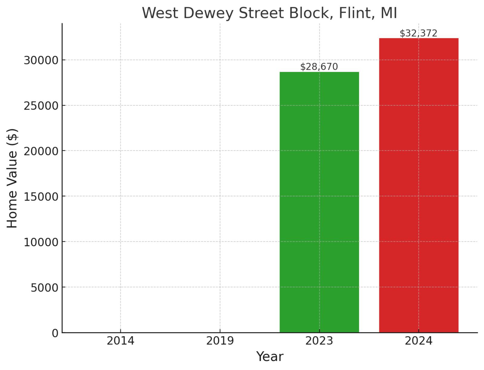
Centered around its namesake thoroughfare, West Dewey Street Block represents one of Flint’s evolving neighborhoods in its ongoing urban renaissance. Located in the city’s western quadrant, this community benefits from its proximity to Kettering University and the University Avenue corridor. Recent years have shown promising growth, with values rising from $28,670 in 2023 to $32,372 in November 2024, marking a robust 12.9% increase in just one year, though earlier historical data isn’t available to track longer-term trends.
Where is West Dewey Street Block on the map?
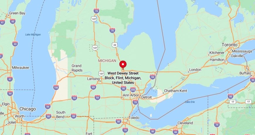
It’s located in Flint, Michigan, within the city’s residential neighborhoods. It is characterized by modest single-family homes and proximity to local schools, parks, and essential services. The area is part of Flint’s ongoing community development efforts to improve housing and neighborhood conditions.
27. Mooretown and Hollywood Heights, Shreveport, LA
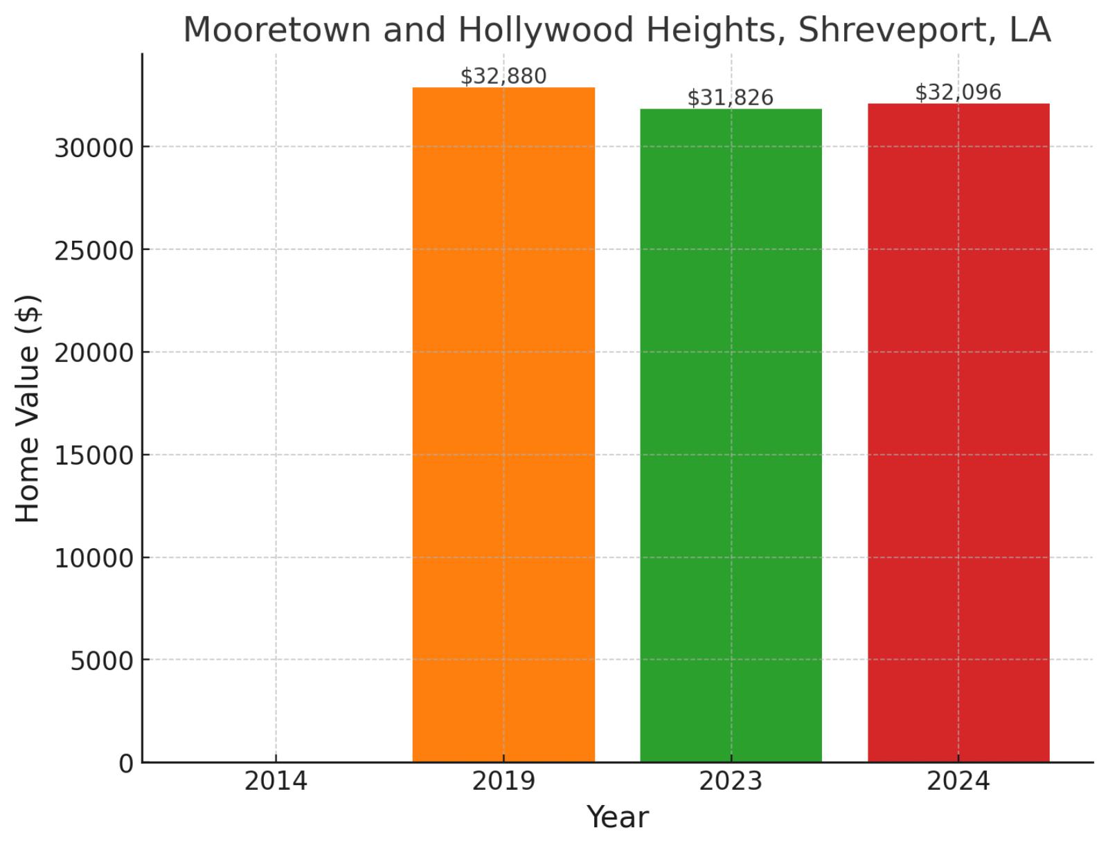
Straddling the northwestern edge of Shreveport, Mooretown and Hollywood Heights form a distinctive community with deep cultural roots. These paired neighborhoods sit near Interstate 20, offering residents convenient access to both downtown Shreveport and the region’s major employers. The area’s home values reflect steady market conditions, moving from $32,880 in 2019 to $31,826 in 2023, before settling at $32,096 in November 2024. While showing a slight 2.4% decline since 2019, the neighborhood has demonstrated stability with a modest 0.8% uptick over the past year.
Where is Mooretown and Hollywood Heights on the map?
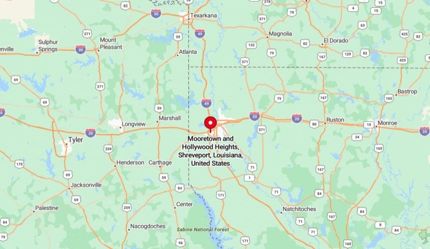
They’re neighborhoods located in the western part of Shreveport, Louisiana. Mooretown is primarily residential, featuring a mix of single-family homes and apartments, while Hollywood Heights is known for its similar housing styles and community-centered environment. The area is near major thoroughfares, providing residents with access to local businesses, schools, and public services. Both neighborhoods are part of Shreveport’s efforts to enhance infrastructure and community resources for residents.
26. Center City, Danville, IL
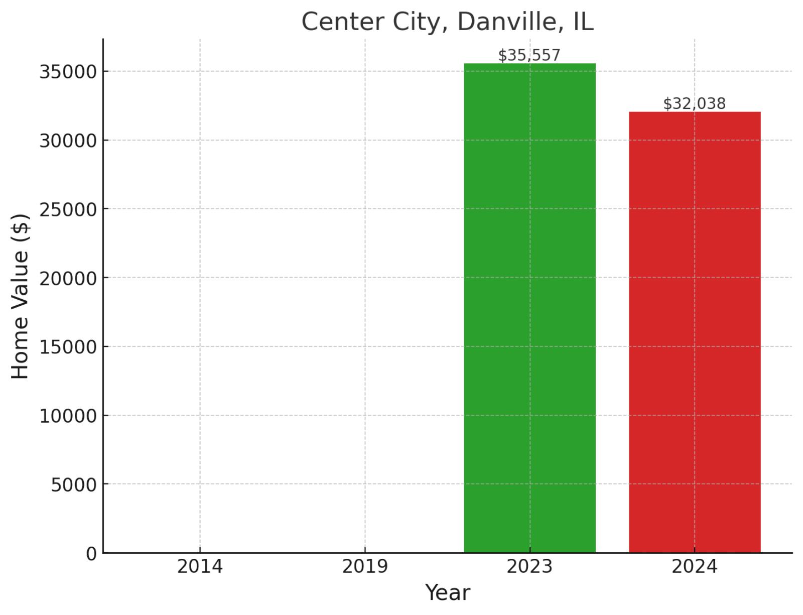
At the heart of Danville lies Center City, a historic district that captures the essence of this Illinois river town. This walkable neighborhood encompasses the city’s primary commercial corridor and sits just blocks from the scenic Vermilion River. Recent market data shows an interesting trajectory, with values shifting from $35,557 in 2023 to $32,038 in November 2024, representing a 9.9% adjustment over the year, though earlier comparative data isn’t available to establish longer-term trends.
Example of a typical 2024 median-priced home in Center City

This home, priced at $39,900, offers 2 large bedrooms and 1 full bathroom on the second floor, with 1,050 square feet of living space. The main floor includes a living room with a wood fireplace, a spacious dining room, and access to a detached one-car garage. The property combines functional living areas with charming features like the fireplace and ample dining space.
Where is Center City on the map?
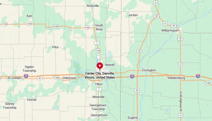
It’s located in the heart of the city, serving as a hub for local businesses, government offices, and community events. The area features a mix of commercial buildings, historic structures, and some residential properties. Its central location provides easy access to amenities, including shops, restaurants, and cultural attractions, making it a focal point for activity in Danville.
25. Saginaw High, Saginaw, MI
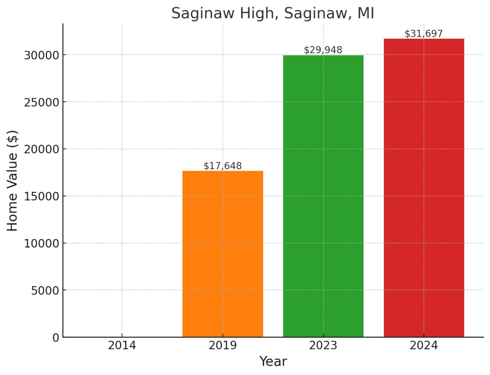
Anchored by its namesake educational institution, the Saginaw High neighborhood represents a crucial piece of this Michigan city’s community fabric. Located in the city’s northeast quadrant, the area benefits from its proximity to both educational facilities and the Saginaw River corridor. Home values have shown remarkable momentum, rising from $17,648 in 2019 to $29,948 in 2023, before reaching $31,697 in November 2024. This trajectory reflects impressive growth of 79.6% since 2019, with continued momentum shown by a 5.8% increase in the past year.
Example of a typical 2024 median-priced home in Saginaw High
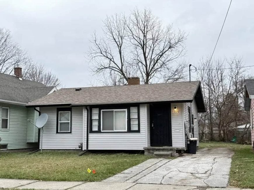
Priced at $40,000, this ranch-style home offers 2 bedrooms, 1 bathroom, and 695 square feet of living space. It features an updated kitchen and bathroom, along with a dimensional shingled roof. The home provides a compact and functional layout at an affordable price.
Where is Saginaw High on the map?
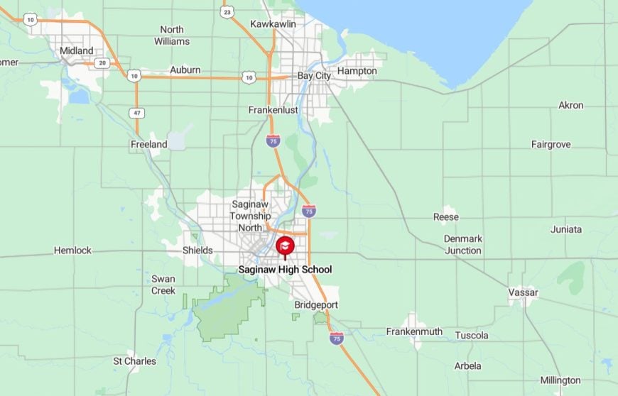
It’s located in Saginaw, Michigan, situated in the northeastern part of the city. It serves as a key educational institution for the community, offering academic, athletic, and extracurricular programs. The area around the school is primarily residential, with nearby local businesses and public facilities. Its location provides convenient access to the city’s main roads, connecting students and residents to the broader Saginaw area.
24. Sterling & Myrtle St., Flint, MI
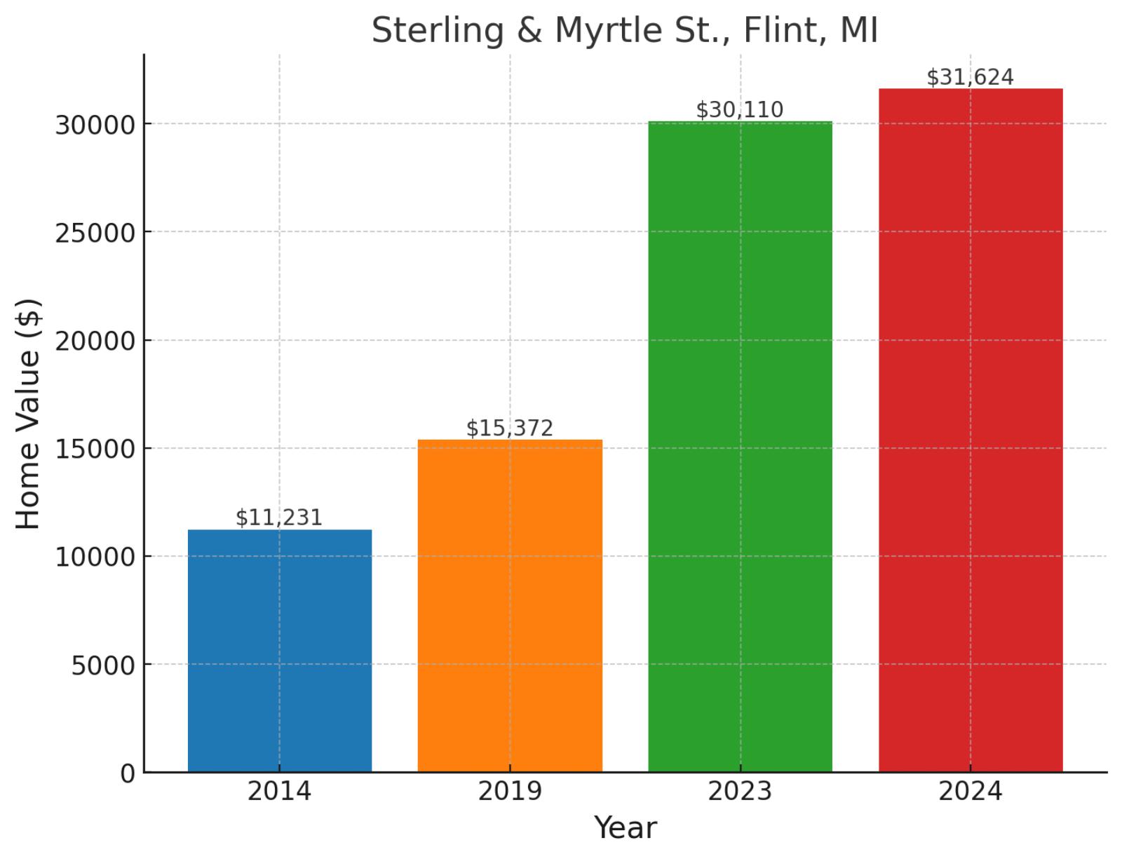
Intersecting at the heart of a historic Flint neighborhood, the Sterling and Myrtle Street area showcases the city’s ongoing revitalization efforts. This community sits just east of downtown Flint, providing residents with easy access to the city’s cultural and commercial core. The neighborhood has experienced dramatic appreciation, with values climbing from $11,231 in 2014 to $15,372 in 2019, then surging to $30,110 in 2023 before reaching $31,624 in November 2024. This remarkable journey represents a 181.6% increase since 2014, bolstered by 105.7% growth since 2019 and a healthy 5% gain in the past year.
Example of a typical 2024 median-priced home in Sterling & Myrtle St.
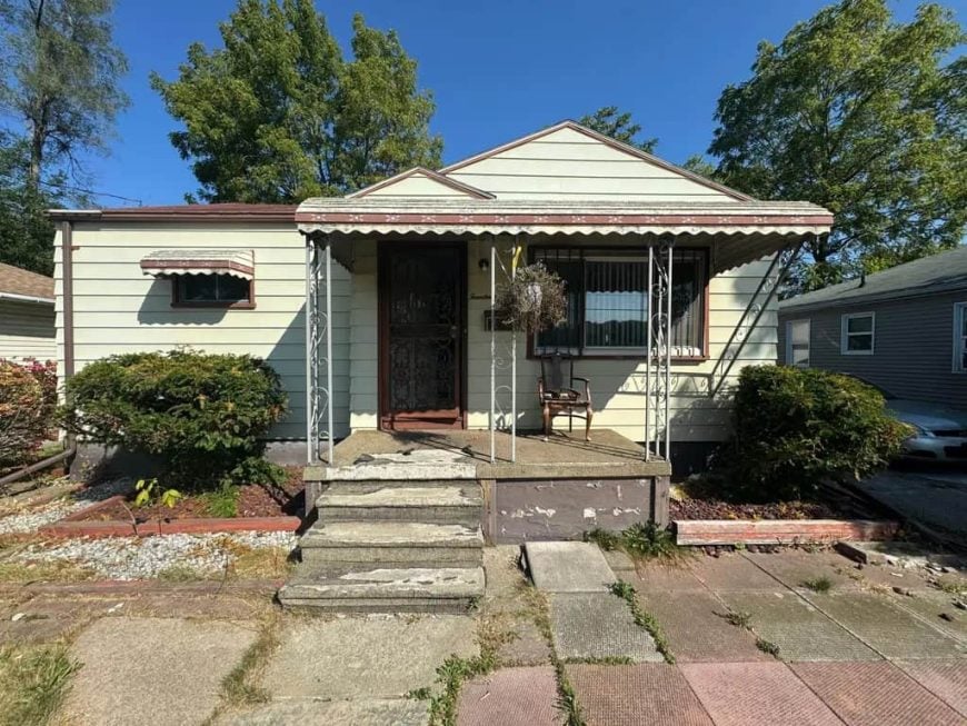
This ranch-style home, priced at $45,000, offers 2 bedrooms, 1.5 bathrooms, and 757 square feet of living space. It includes a partially finished basement, a detached one-car garage, and an oversized driveway for additional parking. The home provides practical features and versatile spaces for its size and price.
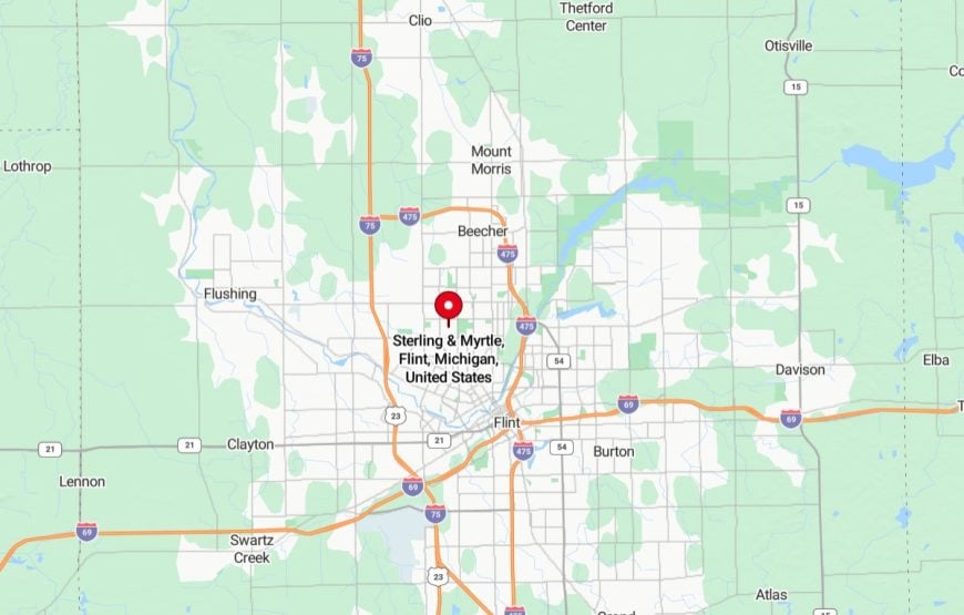
Where is Sterling & Myrtle St. on the map?
23. Utha Street, Jackson, MS
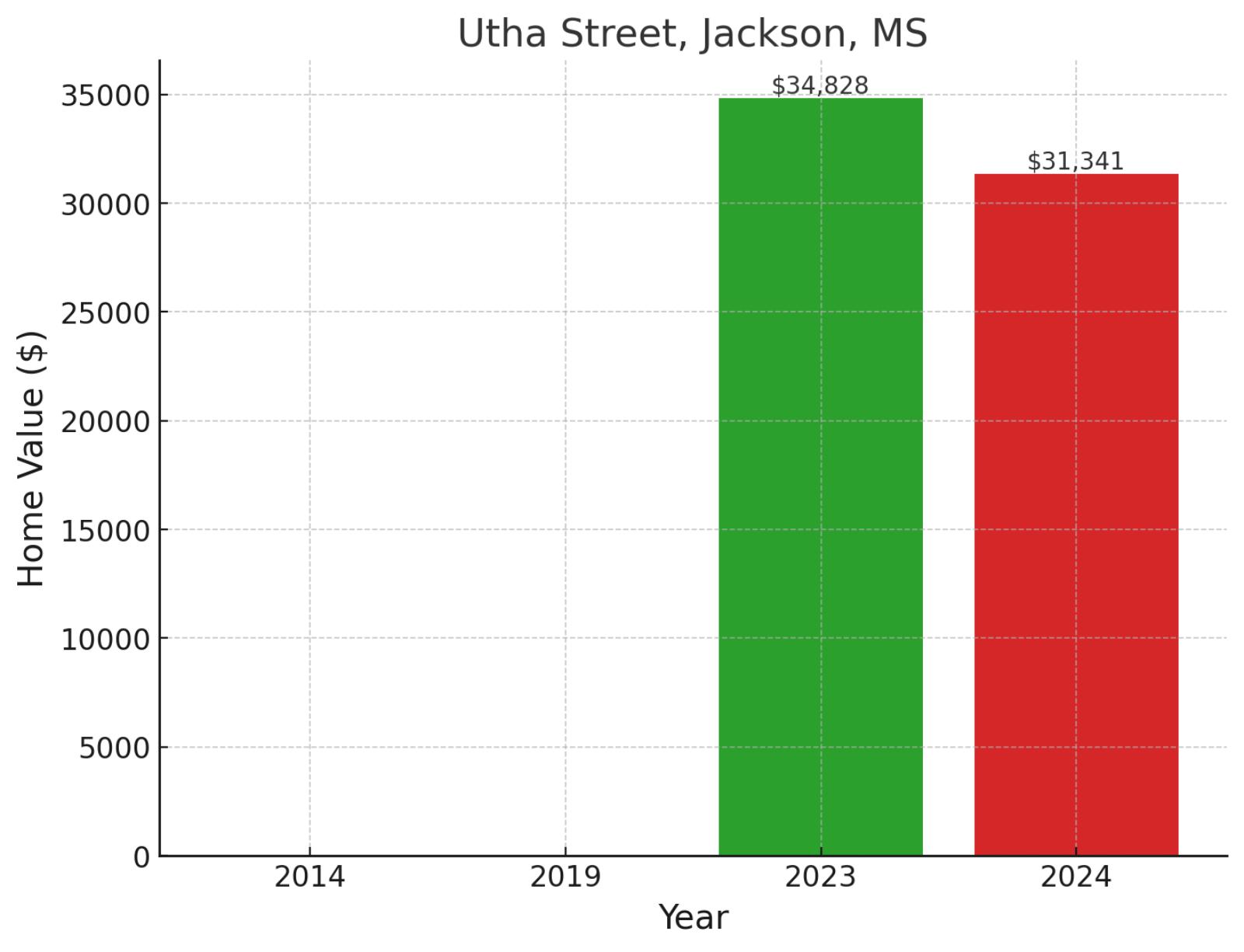
Utha Street neighborhood is located in South Jackson and represents one of the residential communities in this part of Mississippi’s capital city. This South Jackson district is characterized by its residential streets and established neighborhood layout. While historical data is limited, recent market performance shows movement from $34,828 in 2023 to $31,341 in November 2024, reflecting a 10% adjustment over the year as the market seeks equilibrium.
Where is Utha Street on the map?
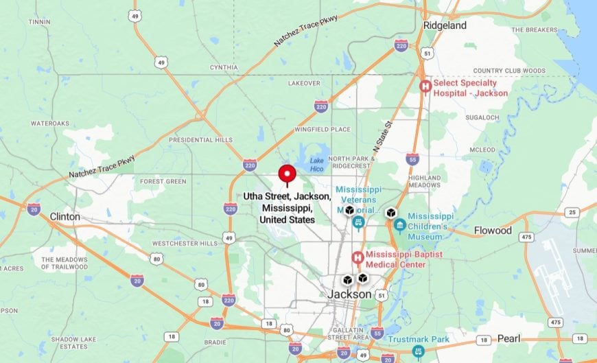
It’s located in Jackson, Mississippi, within a residential area in the city. It is surrounded by a mix of single-family homes and small local businesses, reflecting the neighborhood’s community-oriented character. The street provides access to nearby schools, parks, and essential services, contributing to the area’s convenience for residents.
22. Civic Park, Flint, MI
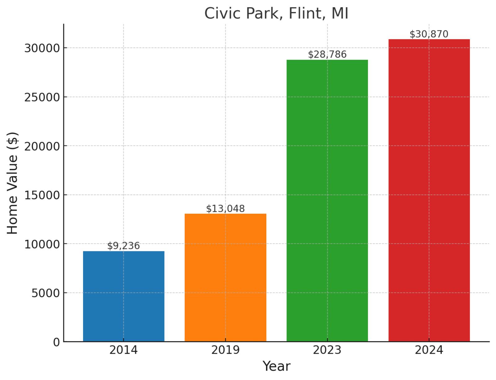
A cornerstone of Flint’s community life, Civic Park holds special historical significance as one of General Motors’ first planned neighborhoods for its workers. Located in the city’s northwest quarter, this historic district showcases distinctive 1920s architecture and tree-lined streets. The area has witnessed remarkable appreciation, with values rising from a modest $9,236 in 2014 to $13,048 in 2019, then dramatically increasing to $28,786 in 2023 before reaching $30,870 in November 2024. This trajectory represents an extraordinary 234.2% growth since 2014, supported by 136.6% appreciation since 2019 and a solid 7.2% gain in the past year.
Example of a typical 2024 median-priced home in Civic Park

Priced at $35,000, this home offers 3 bedrooms, 1 bathroom, and 722 square feet of living space. It features a spacious layout with ample natural light and a comfortable atmosphere. The kitchen includes modern appliances, and the living areas provide functional spaces for relaxation.
Where is Civic Park on the map?
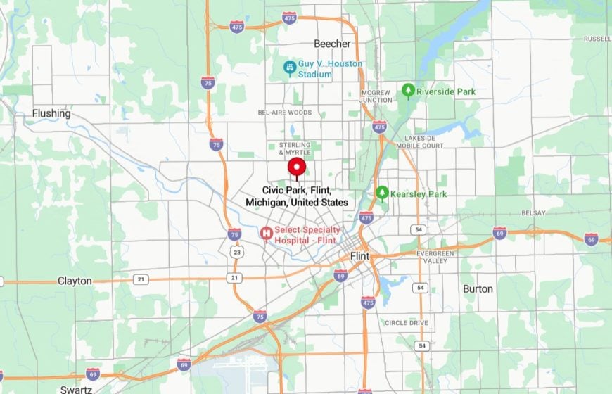
It’s a historic neighborhood in Flint, Michigan, located on the city’s west side. It was developed as a planned community in the early 20th century and features a mix of modest single-family homes and tree-lined streets. The neighborhood is close to schools, parks, and local businesses, reflecting its community-oriented design and convenient location.
21. Warren, Youngstown, OH
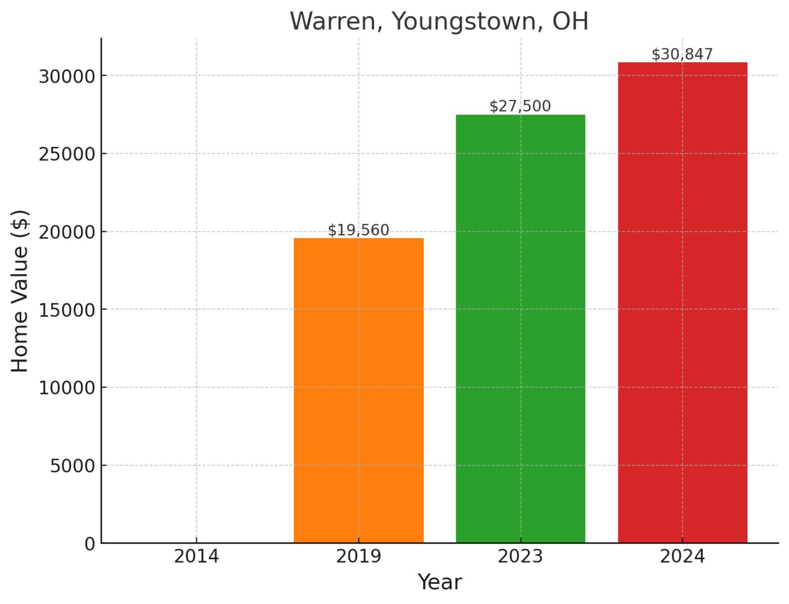
Located in the eastern section of Youngstown, the Warren neighborhood showcases the city’s industrial heritage and ongoing community reinvention. Positioned near key transportation arteries, this area provides residents with easy access to both downtown Youngstown and regional amenities. The neighborhood has shown significant progress, with values rising from $19,560 in 2019 to $27,500 in 2023, before reaching $30,847 in November 2024, demonstrating robust growth of 57.7% since 2019 and a healthy 12.2% gain in the past year.
Where is Warren on the map?
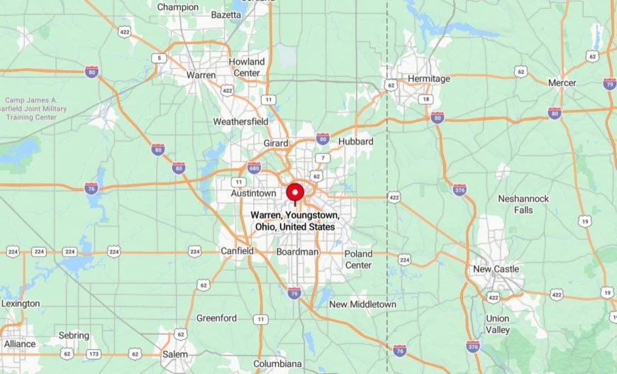
It’s a city located near Youngstown, Ohio, situated in Trumbull County in the northeastern part of the state. It serves as the county seat and is part of the greater Youngstown-Warren metropolitan area. The city features a mix of residential neighborhoods, industrial areas, and cultural landmarks, including historic buildings and public parks. Warren is conveniently connected to Youngstown and surrounding regions via major highways, offering access to employment, shopping, and recreational opportunities.
20. East Side, Youngstown, OH
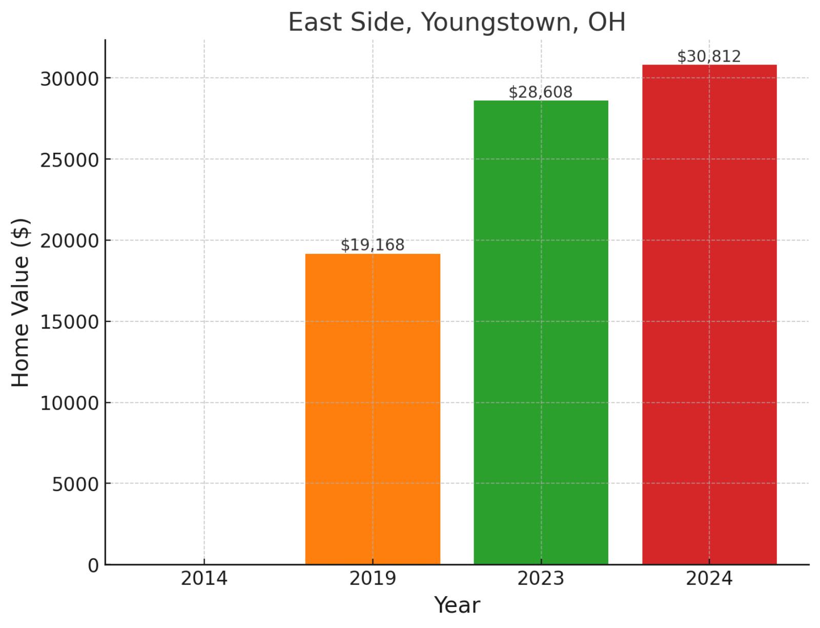
Stretching along Youngstown’s eastern flank, this historic district represents one of the city’s most established residential areas. The neighborhood borders important educational and commercial corridors, offering residents a blend of urban amenities and residential character. Home values have shown steady appreciation, climbing from $19,168 in 2019 to $28,608 in 2023, before reaching $30,812 in November 2024, marking impressive growth of 60.8% since 2019 and a solid 7.7% increase in the past year.
Where is East Side on the map?
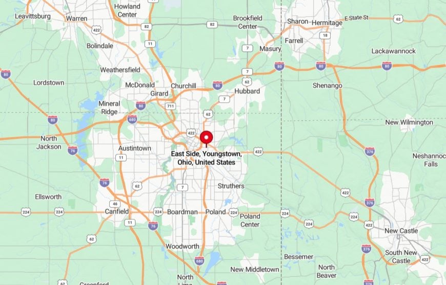
It’s a residential and industrial area located east of the city’s downtown core. It is characterized by a mix of single-family homes, small businesses, and industrial facilities. The neighborhood has access to major roads, such as U.S. Route 422, providing connectivity to other parts of the city and nearby regions. Efforts are ongoing in the area to support community development and revitalize housing and infrastructure.
19. Oaklawn Fairweight, Danville, IL
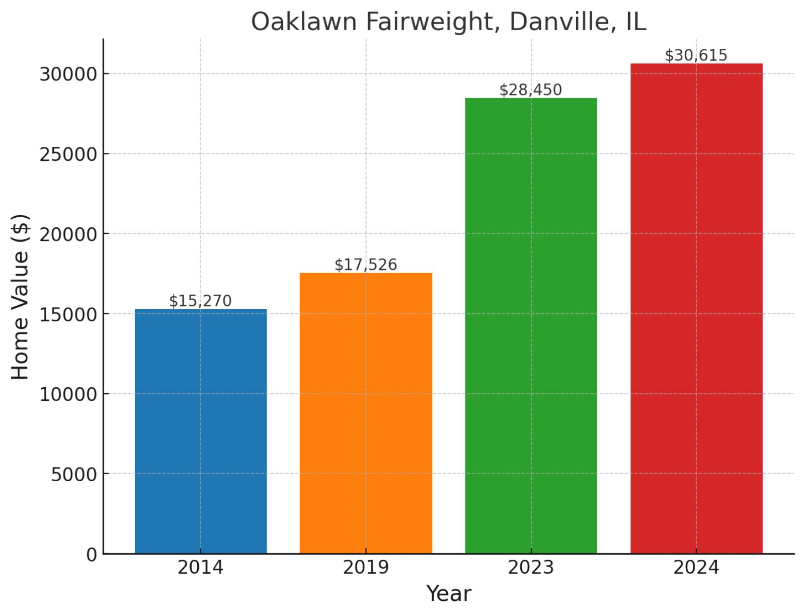
Nestled in the heart of Danville, Oaklawn Fairweight combines small-town charm with accessibility to urban amenities. This established neighborhood sits near the city’s fairgrounds, providing residents with a unique blend of recreational opportunities and residential quiet. The area has demonstrated remarkable long-term growth, with values rising from $15,270 in 2014 to $17,526 in 2019, then surging to $28,450 in 2023 before reaching $30,615 in November 2024, representing a dramatic 100.5% increase since 2014 and continued momentum with 74.7% growth since 2019.
Where is Oaklawn Fairweight on the map?

It’s a residential neighborhood in Danville, Illinois, located in the eastern part of the city. The area is primarily made up of single-family homes and is known for its community-oriented atmosphere. It is close to local amenities such as schools, parks, and shopping centers, providing convenience for residents. Oaklawn Fairweight is part of Danville’s broader efforts to maintain and enhance the livability of its neighborhoods.
18. Fisher, Mobile, AL
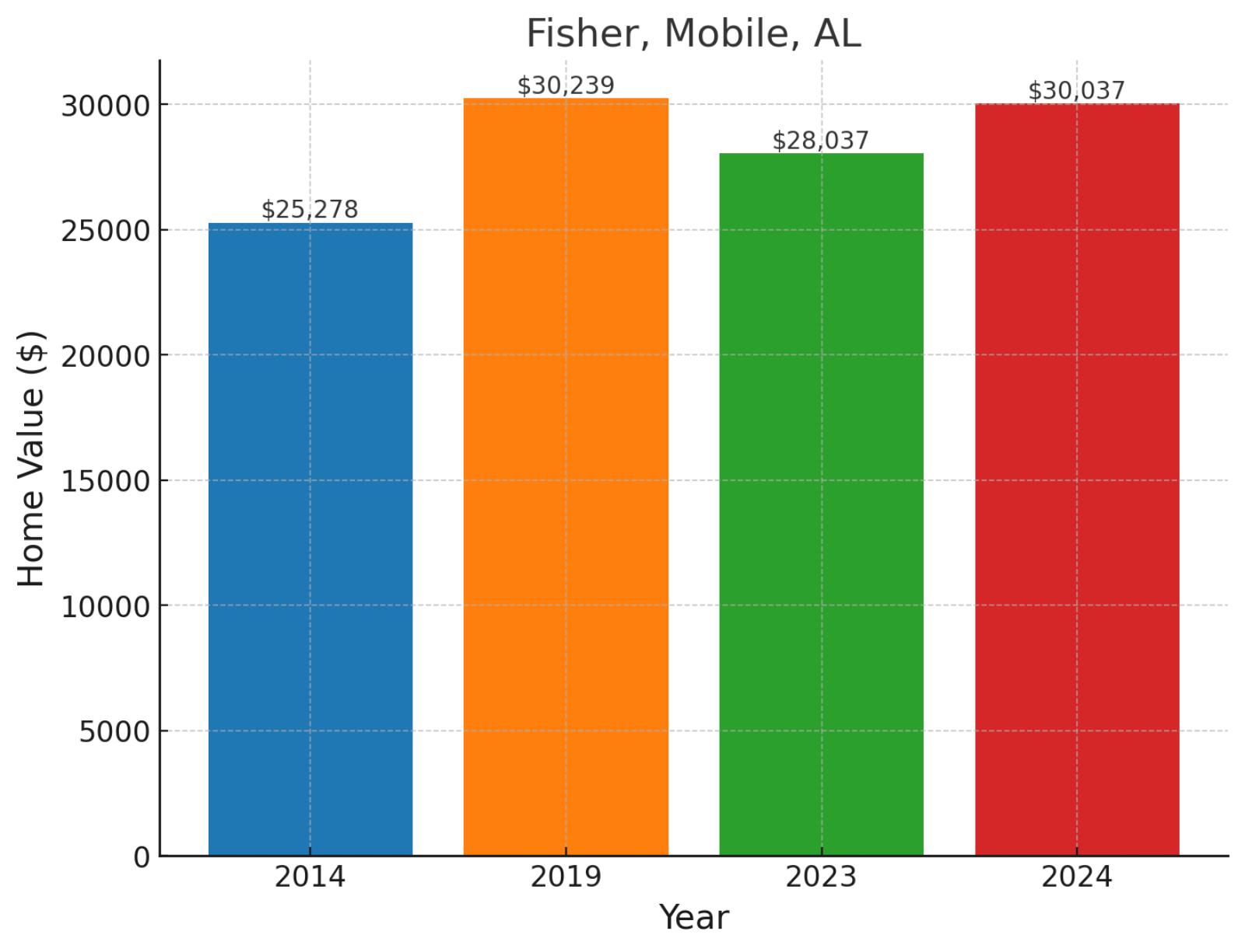
Set within Mobile’s diverse urban landscape, the Fisher neighborhood represents a slice of the city’s rich cultural heritage. Located near major transportation routes, this community offers residents convenient access to both downtown Mobile and the broader Gulf Coast region. Home values show a story of resilience, moving from $25,278 in 2014 to $30,239 in 2019, then adjusting to $28,037 in 2023 before stabilizing at $30,037 in November 2024, reflecting an 18.8% appreciation since 2014 despite recent market fluctuations.
Where is Fisher on the map?
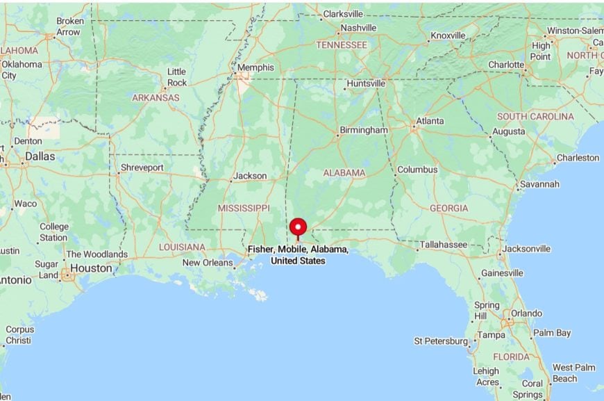
It’s a neighborhood in Mobile, Alabama, located in the northern part of the city. It is a primarily residential area with a mix of single-family homes and local businesses. The neighborhood offers convenient access to nearby schools, parks, and major roads connecting it to other parts of Mobile.
17. Larchmont, Jackson, MS
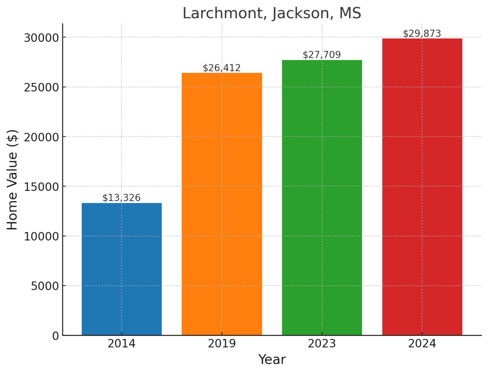
Larchmont is a residential neighborhood located in West Jackson, representing one of the area’s established residential communities. This neighborhood is part of West Jackson’s network of residential streets, characterized by its traditional single-family home layout and quiet residential atmosphere. The area has experienced significant appreciation, with values rising from $13,326 in 2014 to $26,412 in 2019, then climbing to $27,709 in 2023 before reaching $29,873 in November 2024, showcasing impressive 124.2% growth since 2014 and continued strength with a 7.8% gain in the past year.
Where is Larchmont on the map?
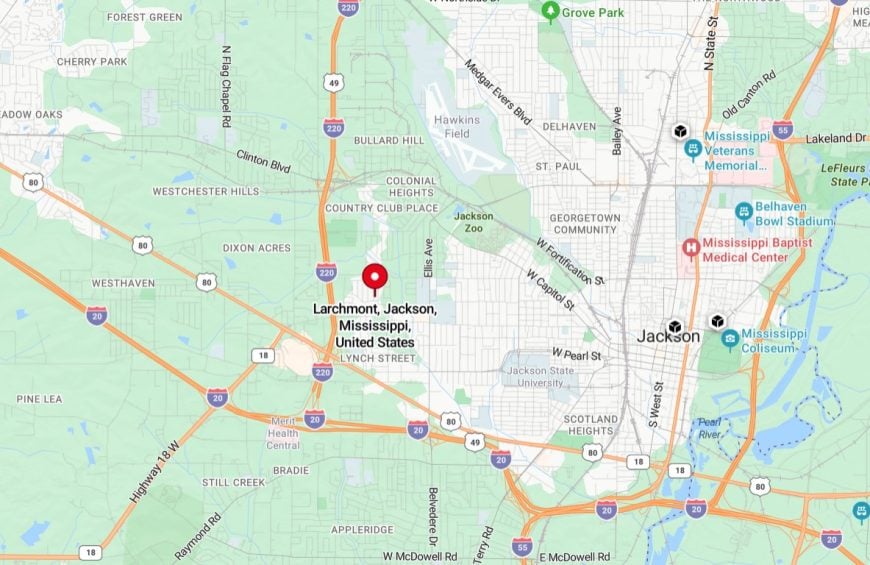
It’s a residential neighborhood in Jackson, Mississippi, located in the western part of the city. It features a mix of single-family homes and local amenities, offering a community-focused environment for residents. The neighborhood provides convenient access to schools, parks, and major roads, connecting it to other areas of Jackson.
16. Savannah Street, Jackson, MS
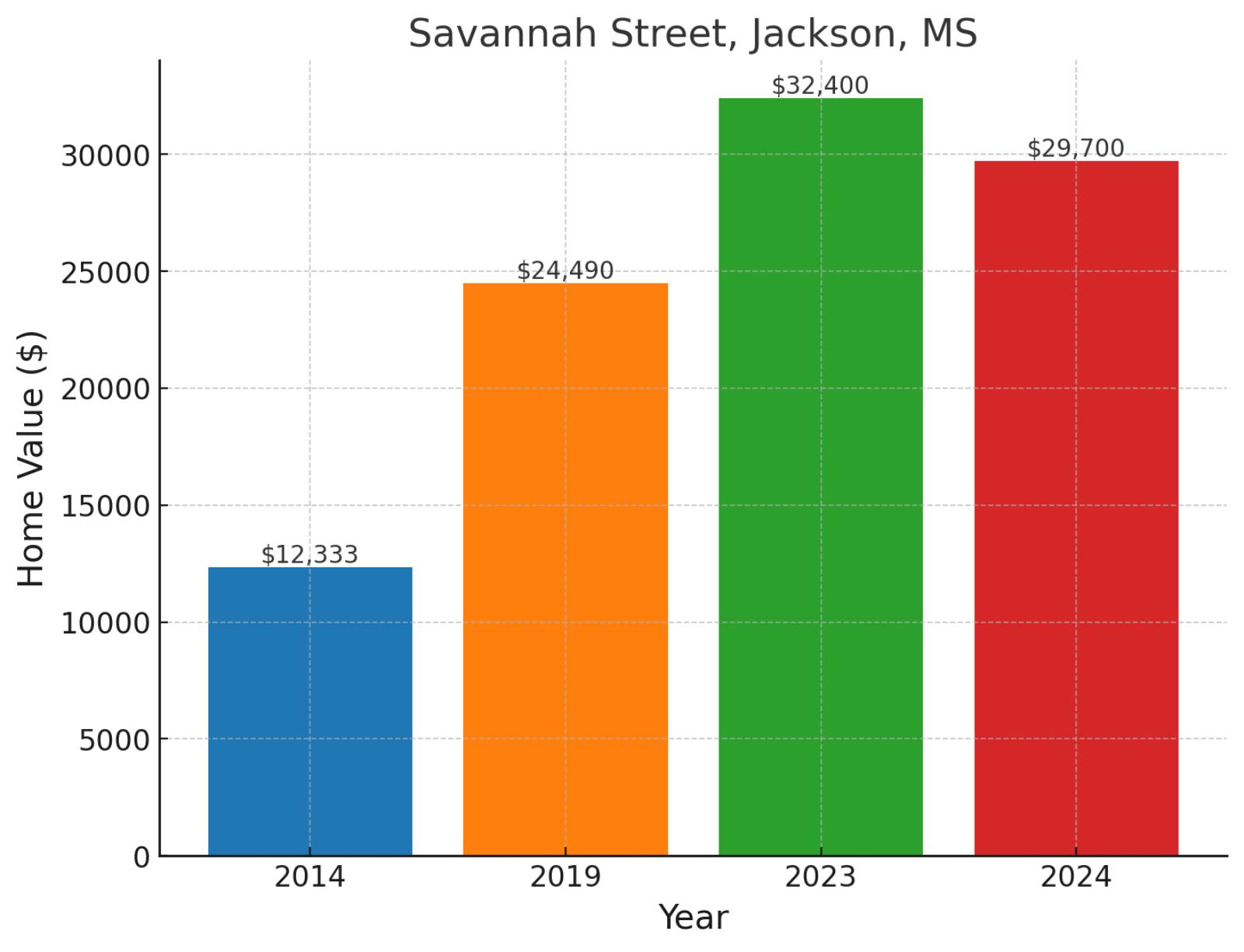
Located in South Jackson, the Savannah Street neighborhood is one of the city’s established residential areas. This South Jackson community is characterized by its residential streets and traditional neighborhood layout, representing one of the area’s long-standing residential districts. Home values tell a story of transformation, climbing from $12,333 in 2014 to $24,490 in 2019, then surging to $32,400 in 2023 before adjusting to $29,700 in November 2024, marking substantial 140.8% growth since 2014 despite a recent 8.3% cooling in the past year.
Example of a typical 2024 median-priced home in Savannah Street
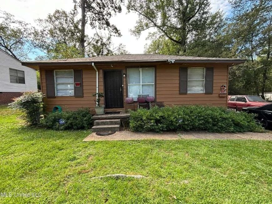
Priced at $39,500, this home offers 3 bedrooms, 1 updated bathroom, and 1,052 square feet of living space. It features original hardwood and tile floors, adding character to the interior. Central air and heating ensure year-round comfort, and a large laundry room provides additional storage. The spacious backyard offers plenty of room for outdoor activities and relaxation.
Where is Savannah Street on the map?

It’s located in Jackson, Mississippi, within a residential area in the southern part of the city. The street features a mix of single-family homes and small local businesses, reflecting the neighborhood’s community-focused environment. Its location provides easy access to nearby schools, parks, and major roadways, connecting residents to other parts of Jackson.
15. Poindexter Park, Jackson, MS
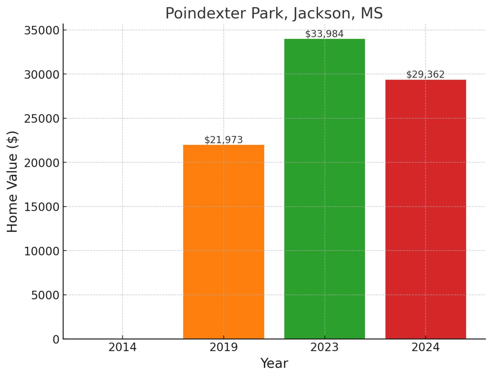
Located in West Jackson, Poindexter Park is a neighborhood that takes its name from the historic park in the area. The community is one of West Jackson’s established residential districts, featuring traditional neighborhood streets and contributing to the area’s residential character. Market performance shows interesting dynamics, with values rising from $21,973 in 2019 to $33,984 in 2023, before settling at $29,362 in November 2024, reflecting 33.6% growth since 2019 despite a recent 13.6% market adjustment.
Where is Poindexter Park on the map?
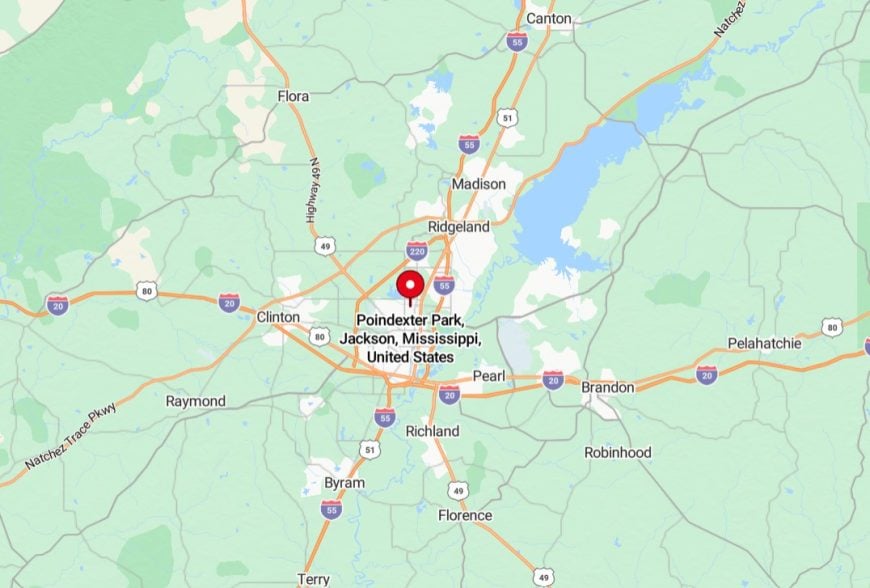
It’s a historic neighborhood located in Jackson, Mississippi, just west of the downtown area. It is named after the nearby Poindexter Park, a community green space that serves as a recreational hub for residents. The neighborhood features a mix of residential homes, historic structures, and small local businesses. Its proximity to downtown Jackson provides easy access to city amenities, making it a convenient and centrally located area for residents.
14. Columbia Heights, Flint, MI
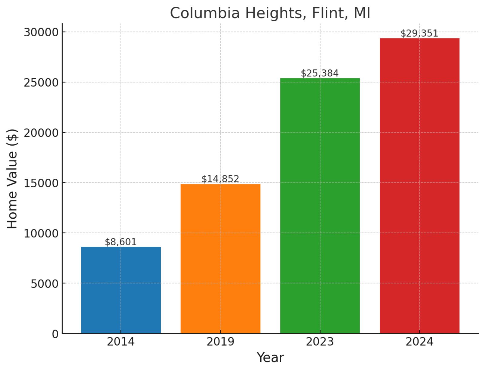
Rising above Flint’s urban landscape, Columbia Heights showcases the city’s remarkable resilience and renewal. This neighborhood sits near major educational institutions, offering residents a strategic location within the city’s evolving framework. The area has experienced dramatic appreciation, with values climbing from just $8,601 in 2014 to $14,852 in 2019, then surging to $25,384 in 2023 before reaching $29,351 in November 2024, marking an extraordinary 241.2% increase since 2014 and maintaining momentum with 15.6% growth in the past year.
Where is Columbia Heights on the map?
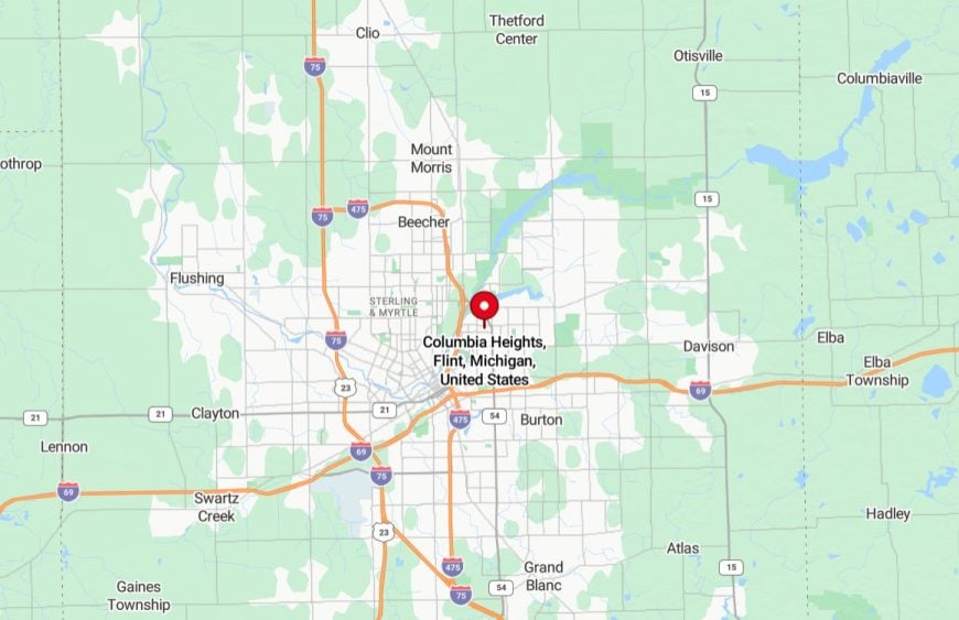
It’s a residential neighborhood in Flint, Michigan, situated on the city’s south side. It consists primarily of single-family homes and is close to local amenities, including schools, parks, and shopping centers. The neighborhood offers convenient access to major roads, connecting it to other parts of Flint and surrounding areas.
13. Lynch Street, Jackson, MS
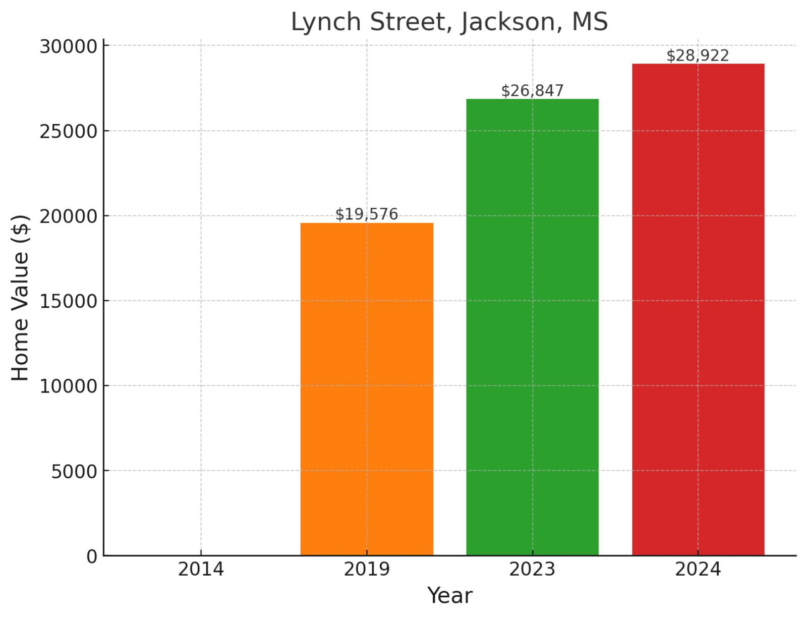
Situated in West Jackson, the Lynch Street neighborhood is situated near Jackson State University along its namesake thoroughfare. This West Jackson community is part of the area surrounding the university, reflecting the district’s connection to one of the city’s major educational institutions. Home values demonstrate strong growth, rising from $19,576 in 2019 to $26,847 in 2023, before reaching $28,922 in November 2024, showing robust 47.7% appreciation since 2019 and continued strength with a 7.7% gain in the past year.
Where is Lynch Street on the map?
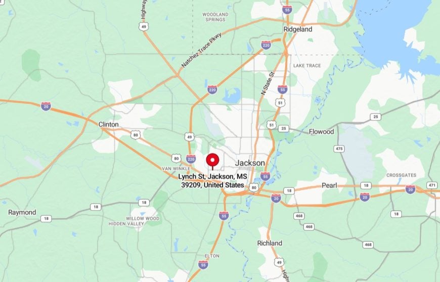
It’s a major thoroughfare in Jackson, Mississippi, running through the western part of the city. It is an important connector, providing access to neighborhoods, local businesses, and institutions, including Jackson State University, which is located along the street. The area around Lynch Street features a mix of residential, commercial, and educational facilities, reflecting its role as a central corridor in the community. Its proximity to key city landmarks makes it a vital part of Jackson’s infrastructure and daily life.
12. Odette, Witherbee, Iroquois, Flint, MI
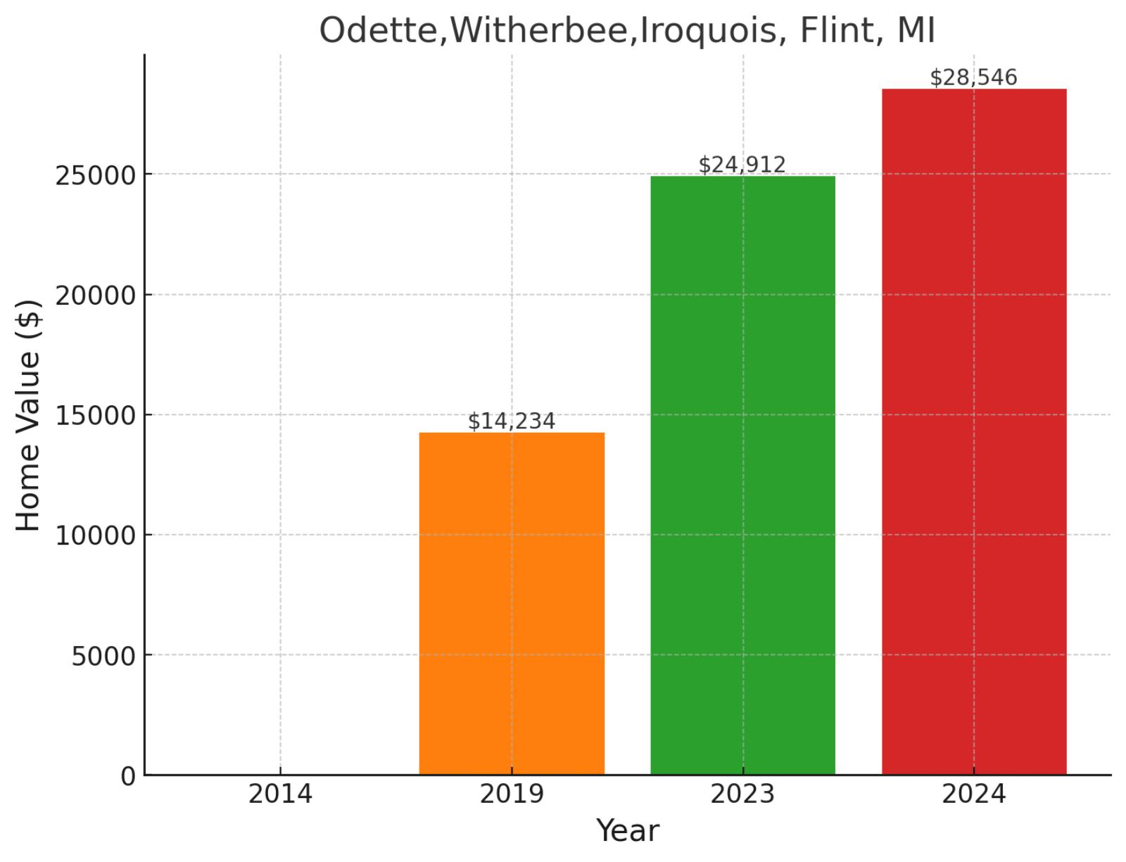
This section of Flint encompasses several residential streets in the city’s evolving urban landscape. The area has demonstrated the same pattern of significant value appreciation seen in many Flint neighborhoods, reflecting broader market trends in the city. The area has shown remarkable market strength, with values climbing from $14,234 in 2019 to $24,912 in 2023, before reaching $28,546 in November 2024, marking impressive 100.5% growth since 2019 and maintaining momentum with a 14.6% increase in the past year.
Where are Odette, Witherbee, and Iroquois on the map?
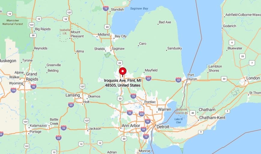
They are residential streets located in Flint, Michigan, within the southeastern part of the city. These streets are part of established neighborhoods featuring a mix of single-family homes and green spaces. The area is near local schools, parks, and essential services, making it convenient for residents. Its location provides easy access to main roads, connecting the community to other parts of Flint and nearby amenities.
11. Allendale, Lakeside, Shreveport, LA
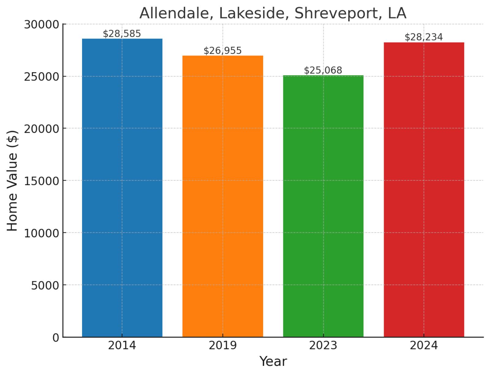
Straddling Shreveport’s western edge, this combined neighborhood area represents one of the city’s most historically significant districts. The community benefits from its proximity to Cross Lake and major transportation routes, offering residents a unique blend of natural beauty and urban accessibility. Home values show an interesting journey, moving from $28,585 in 2014 to $26,955 in 2019, then adjusting to $25,068 in 2023 before rebounding to $28,234 in November 2024, reflecting recent market resilience with a 12.6% gain in the past year despite overall flat performance since 2014.
Example of a typical 2024 median-priced home in Allendale and Lakeside
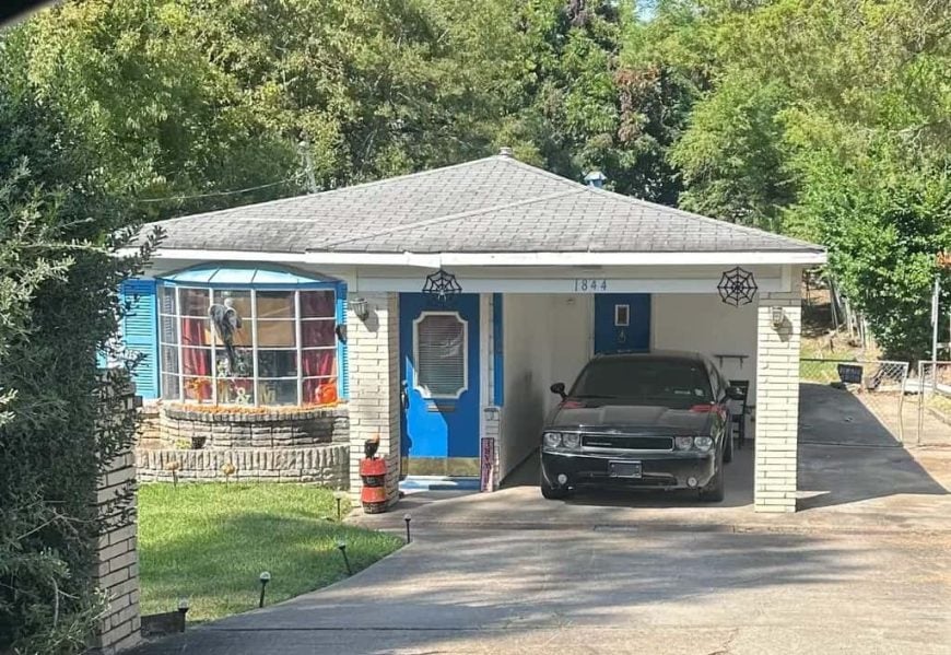
This home, priced at $29,900, offers 3 bedrooms, 2 bathrooms, and 1,543 square feet of living space. The property includes a covered carport, a bay window in the front, and a spacious yard. It provides ample living space at an affordable price, suitable for various lifestyle needs.
Where are Allendale and Lakeside on the map?
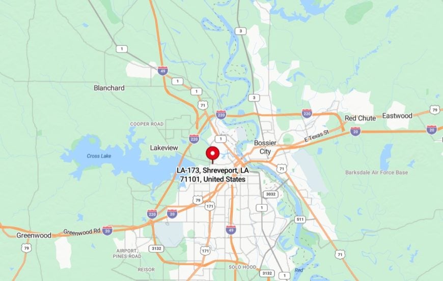
They are adjacent neighborhoods located in Shreveport, Louisiana, situated in the western part of the city near downtown. These neighborhoods primarily feature residential areas with a mix of single-family homes and community spaces. The area is known for its historical significance and ongoing revitalization efforts to enhance housing, infrastructure, and local amenities for residents.
10. Houghton Jones, Saginaw, MI
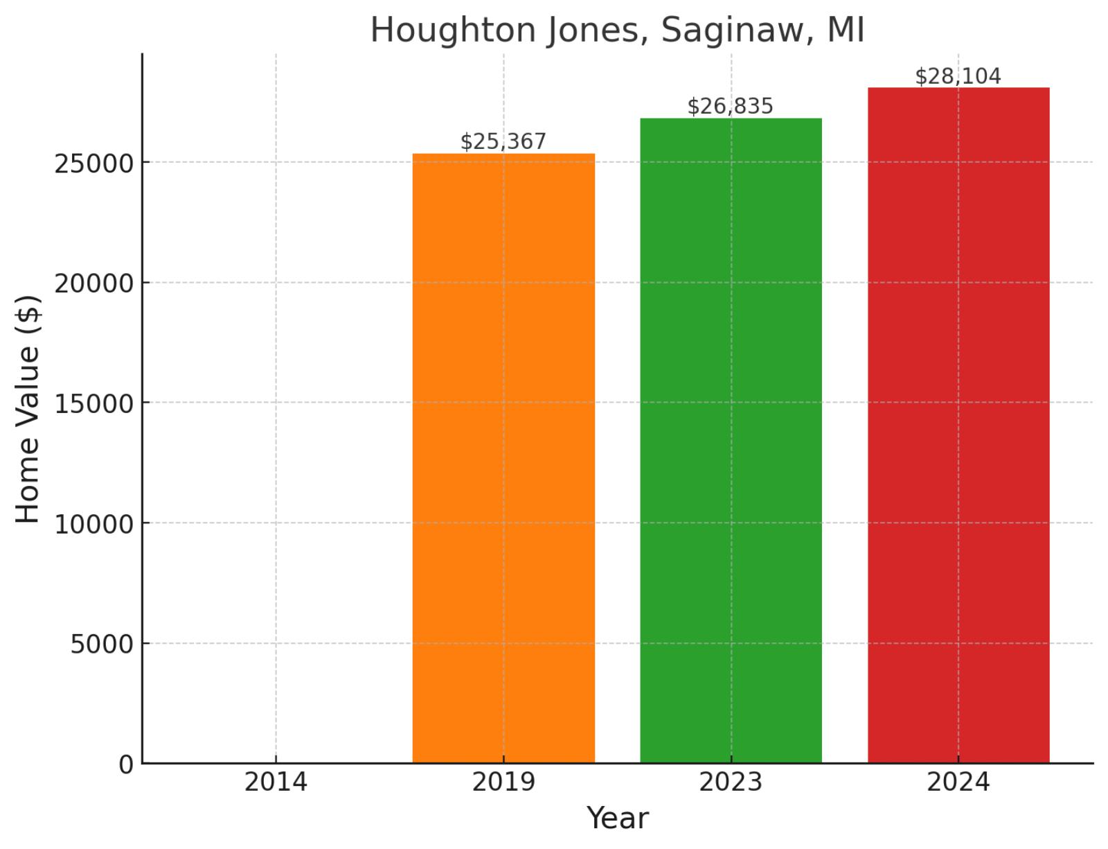
Anchoring a vital section of Saginaw’s urban core, Houghton Jones represents the city’s industrial heritage and ongoing community evolution. This historic neighborhood sits near the Saginaw River, providing residents with both scenic views and easy access to downtown amenities. Market performance shows steady progression, with values rising from $25,367 in 2019 to $26,835 in 2023, before reaching $28,104 in November 2024, demonstrating consistent growth with a 10.8% gain since 2019 and 4.7% appreciation in the past year.
Example of a typical 2024 median-priced home in Houghton Jones
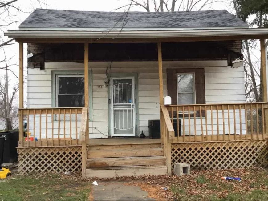
Priced at $25,000, this home offers 4 bedrooms, 1 bathroom, and 1,042 square feet of living space. The property features a covered front porch and a simple layout suitable for various living needs. It provides an affordable option for those seeking a home with multiple bedrooms and functional space.
Where is Houghton Jones on the map?
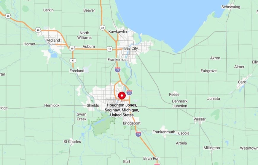
It’s a neighborhood located in Saginaw, Michigan, situated on the city’s west side. It is a primarily residential area with a mix of single-family homes and community resources. The neighborhood is home to the Houghton Jones Neighborhood Resource Center, which offers programs and services to support local residents. Its location provides easy access to nearby schools, parks, and main roads connecting it to other parts of Saginaw.
9. Jayne Avenue, Jackson, MS
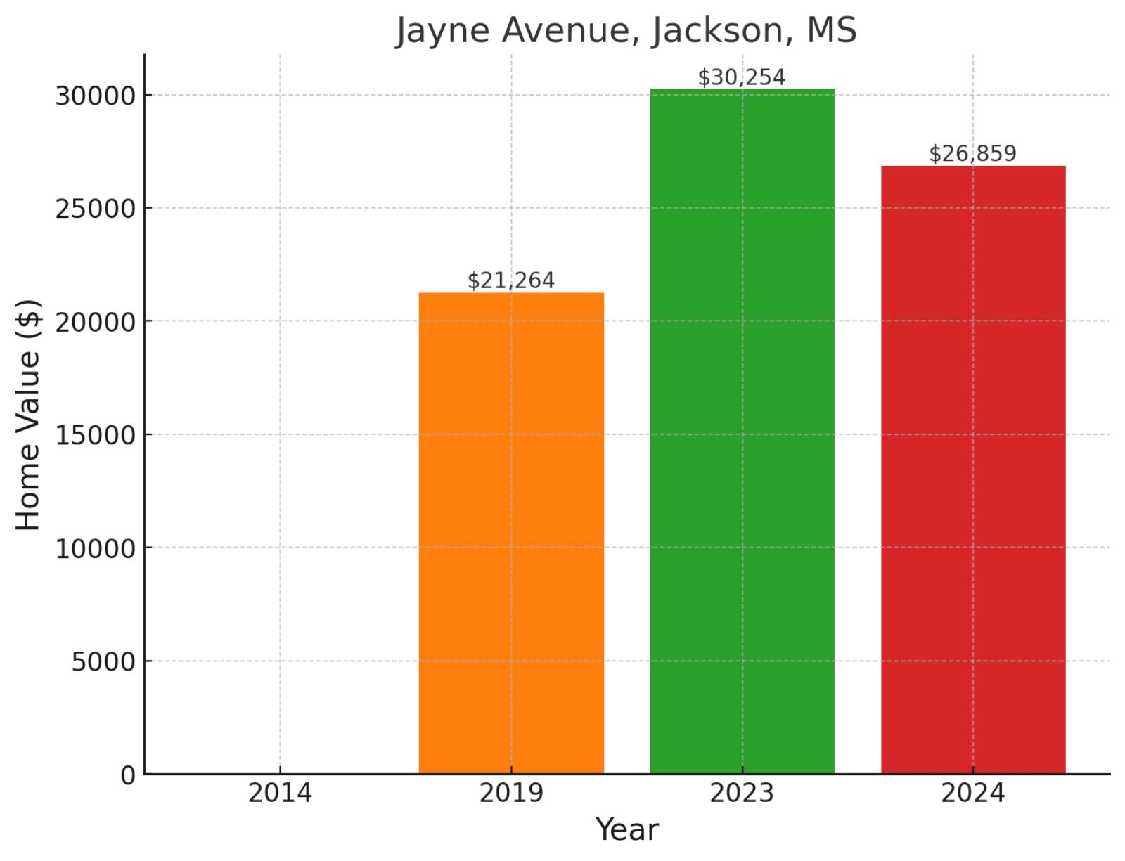
Located in West Jackson, the Jayne Avenue neighborhood exemplifies the city’s residential diversity. This primarily residential area offers very affordable homes. Home values reflect market dynamics, rising from $21,264 in 2019 to $30,254 in 2023, before adjusting to $26,859 in November 2024, showing overall 26.3% growth since 2019 despite an 11.2% recent market correction.
Where is Jayne Avenue on the map?
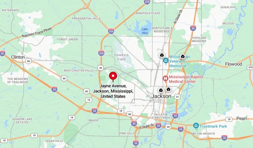
It’s located in Jackson, Mississippi, within a residential area in the northern part of the city. The street is surrounded by single-family homes and is part of a community-oriented neighborhood. It provides convenient access to local schools, parks, and essential amenities. Jayne Avenue is also connected to nearby main roads, allowing easy travel to other areas of Jackson.
8. West Park, Jackson, MS
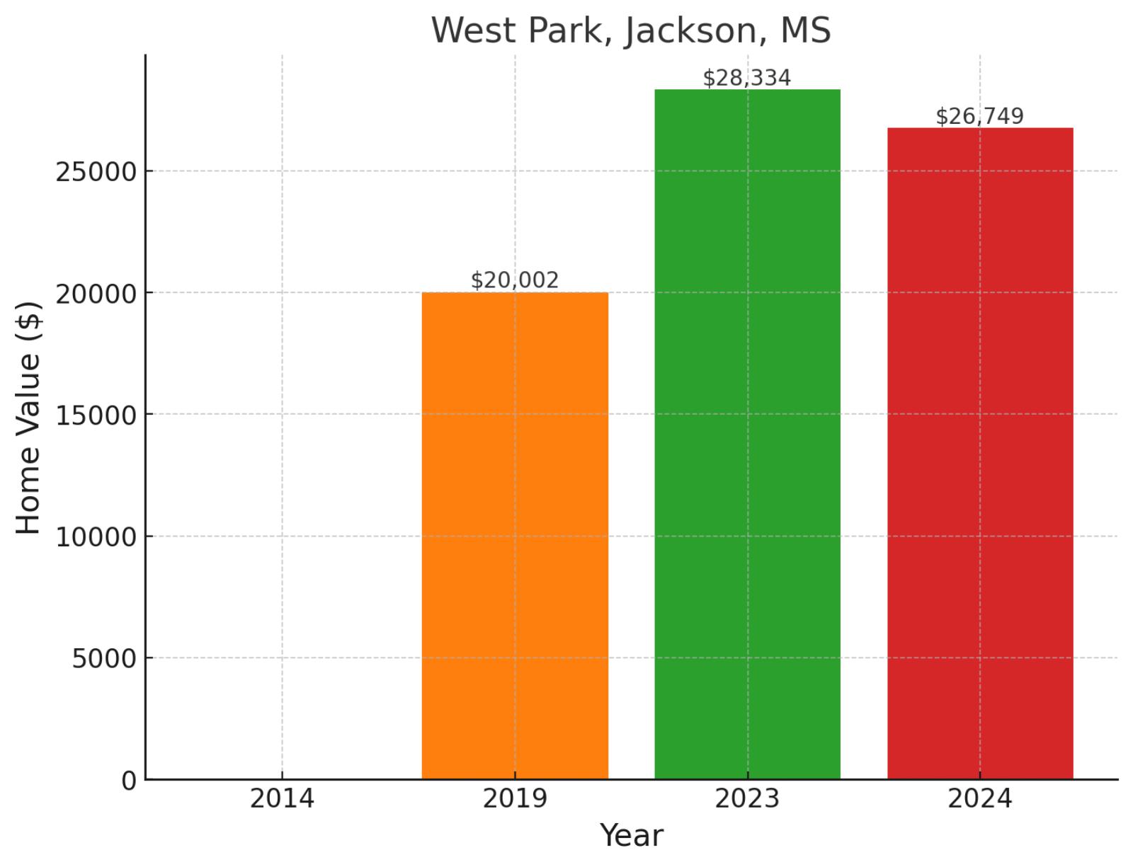
Located in the western section of Jackson, West Park is a primarily residential neighborhood that represents one of the city’s established communities. The area sits along key thoroughfares that connect to Jackson’s downtown corridor, offering residents access to urban amenities while maintaining its residential character. The area has demonstrated notable appreciation, with values climbing from $20,002 in 2019 to $28,334 in 2023, before settling at $26,749 in November 2024, marking 33.7% growth since 2019 despite a recent 5.6% adjustment.
Where is West Park on the map?
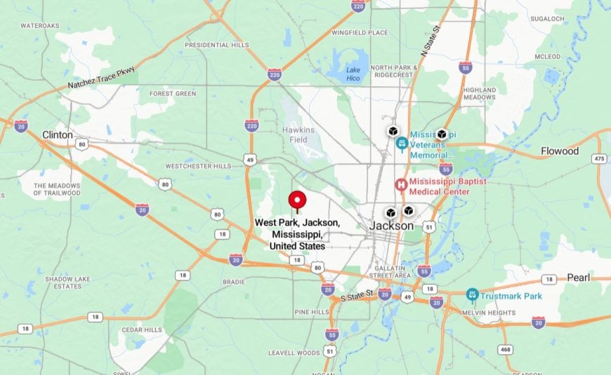
It’s a neighborhood located in Jackson, Mississippi, situated in the western part of the city. It is primarily a residential area with a mix of single-family homes and small local businesses. The neighborhood is near key amenities such as schools, parks, and shopping centers, making it convenient for residents. West Park is also well-connected to other parts of Jackson through major roads and public transportation options.
7. Enochs Street-Hyde Park, Jackson, MS
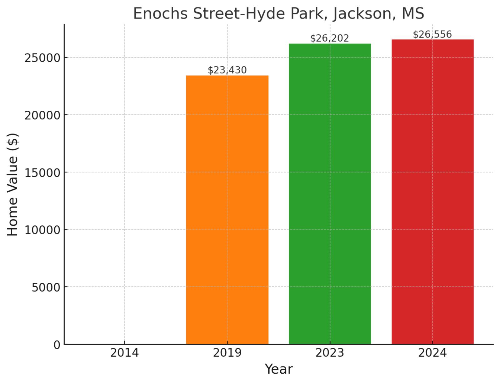
Situated in West Jackson, Enochs Street-Hyde Park is a well-established residential neighborhood that reflects the area’s traditional community character. This predominantly residential district is part of West Jackson’s network of family neighborhoods, characterized by its local streets and established housing stock. Market performance shows steady progress, with values rising from $23,430 in 2019 to $26,202 in 2023, before reaching $26,556 in November 2024, reflecting 13.3% growth since 2019 and continued stability with a 1.4% gain in the past year.
Example of a typical 2024 median-priced home in Enochs Street-Hyde Park
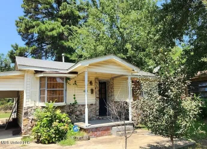
This home, priced at $48,000, offers 3 bedrooms, 1.5 bathrooms, and 1,260 square feet of living space. It features a covered front porch and an oversized yard, providing ample outdoor space. The property offers a functional layout suitable for various living needs.
Where is Enochs Street-Hyde Park on the map?
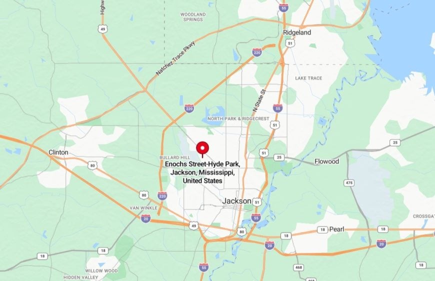
It’s a neighborhood located in Jackson, Mississippi, situated in the western part of the city. It is a primarily residential area with a mix of single-family homes and green spaces. The neighborhood is close to local schools, parks, and essential amenities, offering convenience for residents. Its location provides easy access to major roads, connecting it to other parts of Jackson and nearby commercial areas.
6. Northend Recreation Center, Flint, MI
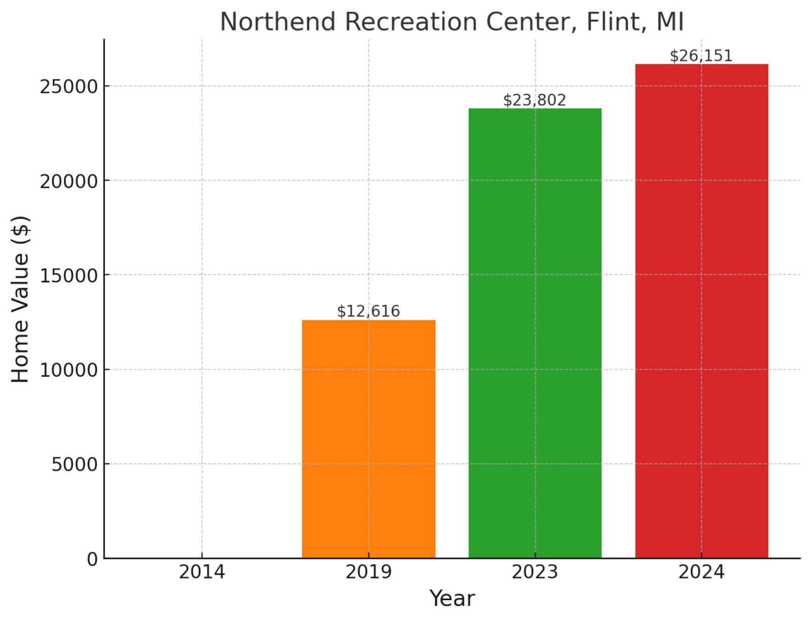
Located in the northern section of Flint, this neighborhood represents one of the city’s residential districts that has experienced significant market appreciation. The area is part of Flint’s network of traditional neighborhoods that have seen notable value increases during the city’s ongoing revitalization efforts. Home values show dramatic improvement, climbing from $12,616 in 2019 to $23,802 in 2023, before reaching $26,151 in November 2024, marking remarkable 107.3% growth since 2019 and maintaining momentum with a 9.9% increase in the past year.
Where is Northend Recreation Center on the map?
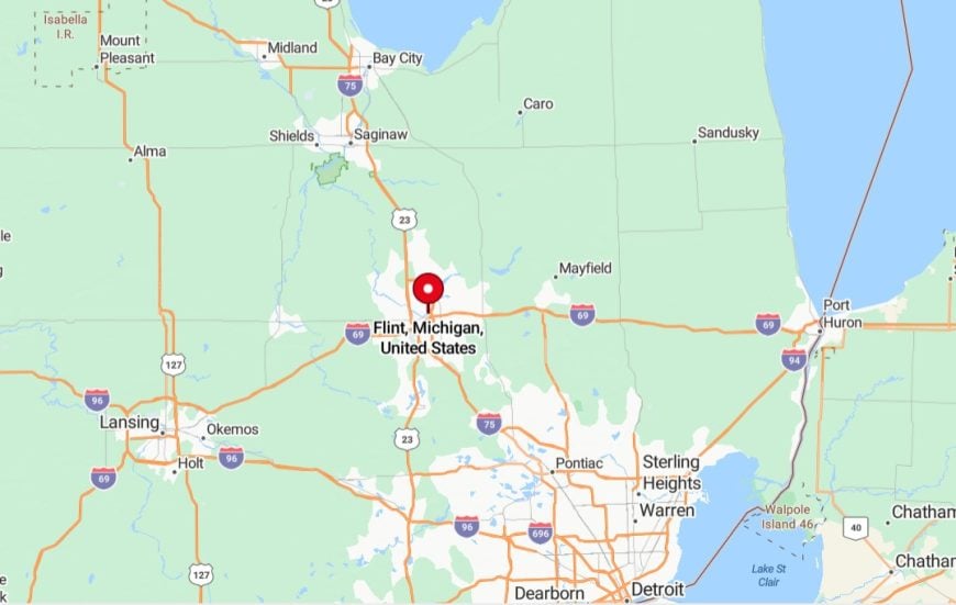
It’s located in Flint, Michigan, in the northern part of the city. It serves as a community hub, offering recreational facilities, programs, and events for residents of all ages. The center is situated near residential neighborhoods and provides access to sports fields, indoor activities, and community gatherings. Its location makes it a vital resource for the surrounding area, promoting engagement and wellness in the community.
5. Skyline DR, Jackson, MS
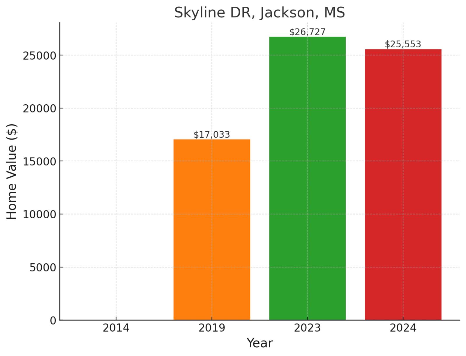
Skyline Drive is an area of Jackson that offers one of the city’s (and the nation) more affordable homes. This elevated neighborhood provides residents with both scenic vistas and convenient access to urban amenities. Market performance reflects significant growth, with values rising from $17,033 in 2019 to $26,727 in 2023, before adjusting to $25,553 in November 2024, showing 50% appreciation since 2019 despite a recent 4.4% cooling.
Where is Skyline DR on the map?
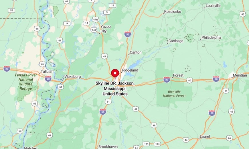
It’s located in Jackson, Mississippi, in the northern part of the city. It is a primarily residential area with a mix of single-family homes and local amenities. The street is close to schools, parks, and shopping centers, providing convenience for residents. Skyline Drive also has easy access to major roads, connecting it to other parts of Jackson and nearby areas.
4. Washington Addition, Jackson, MS
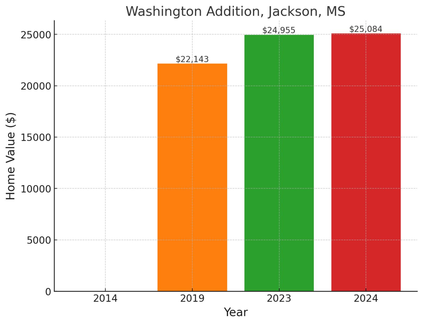
Steeped in Jackson’s civil rights history, Washington Addition stands as one of the capital city’s most culturally significant neighborhoods. This historic district lies east of Jackson State University, offering residents a rich blend of educational resources and community heritage. Home values demonstrate steady appreciation, moving from $22,143 in 2019 to $24,955 in 2023, before reaching $25,084 in November 2024, reflecting 13.3% growth since 2019 and recent stability with a 0.5% gain in the past year.
Where is Washington Addition on the map?
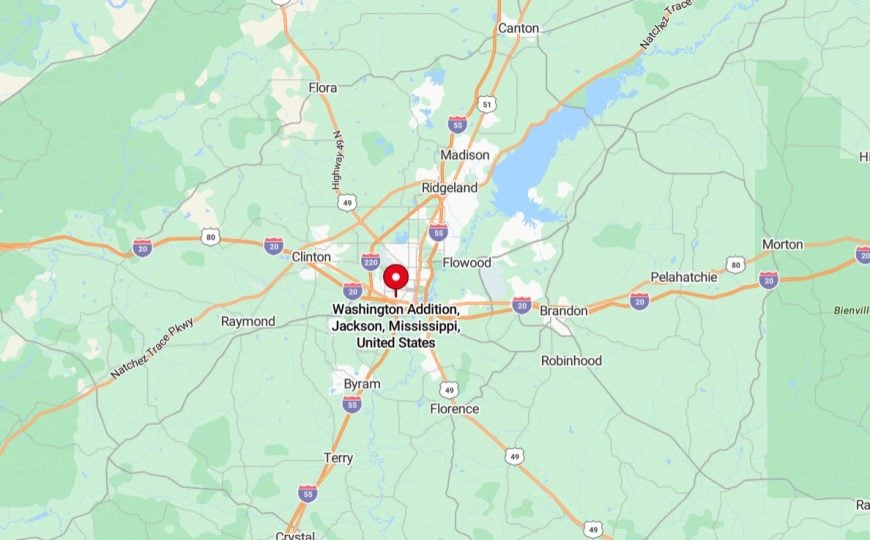
It’s a historic neighborhood located in Jackson, Mississippi, situated just west of the downtown area. It is primarily residential, featuring a mix of single-family homes and small local businesses. The neighborhood is close to schools, parks, and community facilities, offering convenient access to essential services. Washington Addition is also known for its strong community ties and ongoing efforts to revitalize housing and infrastructure in the area.
3. Englewood, Jackson, MS
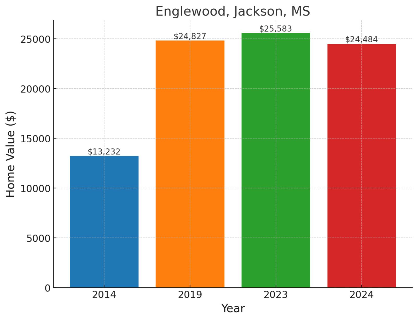
Nestled in the western side of Jackson, Englewood represents one of the city’s most affordable areas. This established neighborhood sits within walking distance of major employers and commercial corridors, offering residents a truly urban lifestyle. The area has shown remarkable long-term appreciation, with values rising from $13,232 in 2014 to $24,827 in 2019, then reaching $25,583 in 2023 before settling at $24,484 in November 2024, marking 85% growth since 2014 despite recent market adjustments.
Where is Englewood on the map?

It’s a residential neighborhood located in Jackson, Mississippi, situated in the southern part of the city. The area features a mix of single-family homes and is close to local schools, parks, and essential amenities. Its location provides easy access to major roads, connecting it to other parts of Jackson and surrounding areas.
2. Country Club Place, Jackson, MS
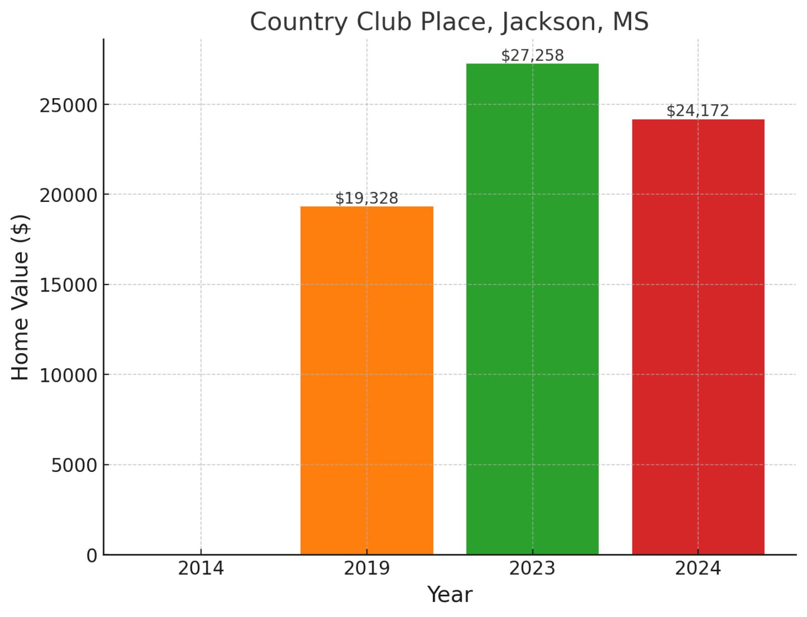
Despite its aspirational name, Country Club Place represents one of Jackson’s most affordable residential opportunities. Located in the city’s western sector, it’s primarily a residential area. Market performance shows interesting dynamics, with values climbing from $19,328 in 2019 to $27,258 in 2023, before adjusting to $24,172 in November 2024, reflecting overall 25.1% growth since 2019 despite an 11.3% recent market correction.
Where is Country Club Place on the map?
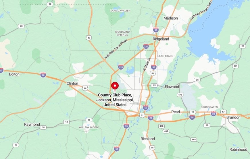
It’s a neighborhood located in Jackson, Mississippi, situated near the city’s northeastern area. It is primarily residential, featuring a mix of single-family homes in a well-established community. The neighborhood is close to local amenities, including schools, parks, and shopping centers, providing convenience for residents. Its location also offers easy access to major roads, making it well-connected to other parts of Jackson and surrounding areas.
1. Bullard Hill, Jackson, MS
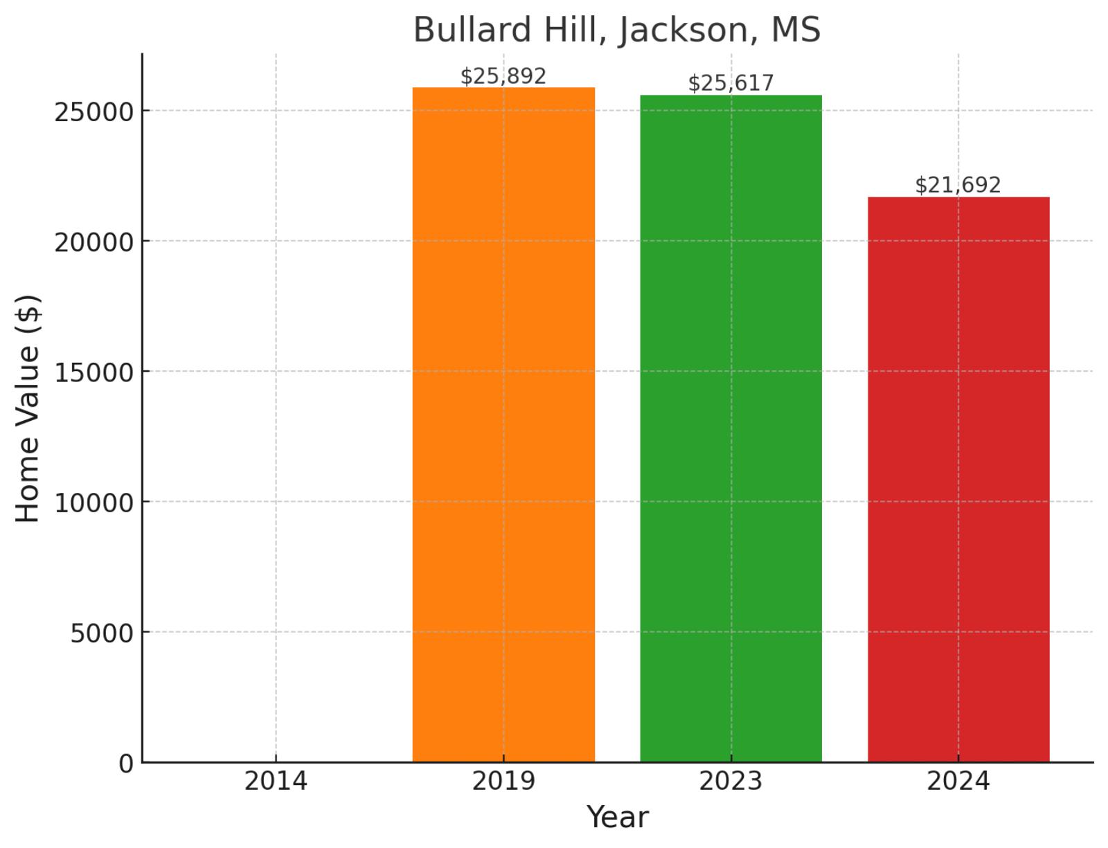
Anchoring Jackson’s western residential district, Bullard Hill stands as the most affordable neighborhood in our analysis. This established community sits at the intersection of major thoroughfares, providing residents with convenient access to both urban amenities and suburban corridors. Market data shows recent challenges, with values declining from $25,892 in 2019 to $25,617 in 2023, before reaching $21,692 in November 2024, reflecting a 16.2% decrease since 2019 and a 15.3% adjustment in the past year.
Where is Bullard Hill on the map?
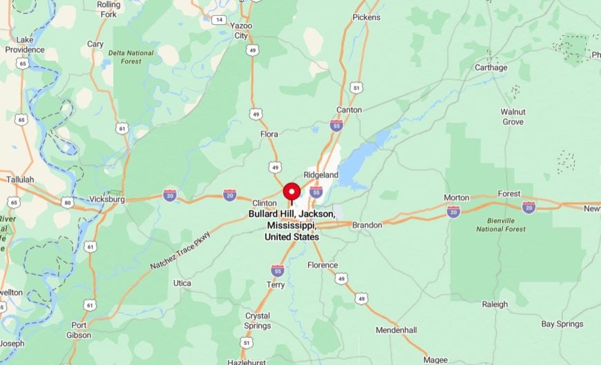
It’s a neighborhood located in Jackson, Mississippi, in the southern part of the city. It is primarily residential, featuring single-family homes and a community-oriented atmosphere. The area is near schools, parks, and local amenities, making it convenient for residents. Its location provides easy access to major roadways, connecting it to other parts of Jackson and surrounding areas.


